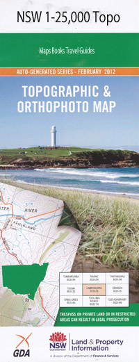
Lower Portland 1-25,000 NSW Topographic Map
$16.95 – $31.95
Description:
9031-2-S Print on Demand
Rosemont Carinya Ko-Veda Rosevale Ward Park Nangadoo Brad-Lea Una Voce Volitude Nardoo Lambourne Walkers Beach Buckenbah Sandpiper Torrens The Lodge Straument The Ranch Aloha Bonnie Doon Ferndale Wiggins Farm Bainton Bimbimbi Gooriwa Dargle Ponytail Farm Ponderosa Richmond Park Everglades Warrawee Allanson Sackville Gardens Tinzanna Willow Bend Big Red Kiata Stonehouse Grove Hillcrest Merrit Farm Morundah Brolga Bathurst Reach Blue Gum Gully Blue Gum Hollow Blaxlands Ridge Blackstone Bradleys Swamp Brewangle Field Studies Centre Cambridge Reach Central Colo Churchills Wharf Colo Comleroy State Forest Cooper Cornelia Cumberland Reach Fernbed Gully Fowlers Gully Gees Arm Gees Lagoon Gloucester Reach Greens Creek Greens Swamp Green Swamp Green Swamp Creek Halls Swamp Hawkesbury Hunter Ironbark Ridge Irwins Swamp Jubilee Vineyard Creek Kent Reach Greens Gully The Green Swamp Gum Gully Hayes Swamp Lambs Creek Leets Vale Liverpool Reach Lower Half Moon Bend Lower Half Moon Reach Lower Portland Lower Portland Public School Maroota Maroota North Maroota Historic Site Meehan Metheringhams Hill Milkmaid Reach Mill Creek Mitchell Moran Morans Rock Old Mill Dam Portland Head Portland Head Rock Portland Lower Public School Portland Reach Rock Wharf Sackville Reach Skeleton Rocks Stone Chimney Arm Stringybark Spur Sussex Reach Teatree Swamp Trotts Gully Turnbulls Arm Turnbulls Hill Turnbulls Swamp Upper Half Moon Bend Vale Ridge Walker Weatherboard Ridge Weavers Whatleys Arm Whatleys Creek Whatleys Gully Wheelbarrow Wilsons Jetty Wisemans Ferry Wisemans Ferry Historic Site Wisemans Ferry Park Wisemans Ferry Public School Bullock Wharf Doyles Creek Doyles Swamp Doyles Swamp Creek Sackville North Memorial Park Kurrajong East Byrnes Rock Malvina Bower Sackville North Jackson Creek Douglass Creek Leets Creek Blundells Creek Paradise Point Webbs Creek Macdonald River Wheeny Creek Colo River Nepean River Sackville The Bull Ridge
| Name: | Lower Portland |
| Publisher: | New South Wales Government |
| Scale: | 1:25000 |
| Latitude Range: | 33° 22.5′ S – 33° 30.0′ S |
| Longitude Range: | 150° 45.0′ E – 151° 0.0′ E |
| Datum: | GDA 94 |
| Approx Print Size: | 0.56m X 1.11m |

