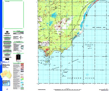
Malcolm Special 1-250,000 Topographic Map
$15.95 – $30.95
Description:
Print on Demand
6 Mile Island Andrews Point Anvil Island Archdeacon Island Arid Bay Arid Island Arid Strait Ark Point Austin Bank Baandadup Well Baelmayalina Gnamma Hole Balbinya Barrier Anchorage Barrier Island Bearing Rock Bebenorin Hill Belinda Beach Belinup Hill Bellinger Island Bilbunya Dunes Bills Paddock Blind Rocks Bonnie Hill Boulder Rock Boyatup Boyatup Hill Breeborinia Rock Brewis Island Bringabinya Rock Brooks Peak Brown Bay Calothamnus Point Cape Arid Cape Arid Creek Cape Arid National Park Cape Pasley Cape Pillar Rock Capewelluck Spring Carnigup Hill Chating Yagenup Chester Reef Chugarlunginya Rock Cooper Island Cormorant Cove Cormorant Rock Coverdale Cove Cranny Island Dailey Island Daringdella Lake Darling Shoal Daw Island Deralinya Disphyma Point Dome Island Douglas Island Eastern Group Eclipse Hill Fern Creek Finch Shoal Flinders Peak Florabel Hill Ford Island Fowlie Hill Franklin Rock Garbabarlobulla Rock Gardner Rock Gecko Cave Gegelup George Island Glencoe Ruins Glennie Island Goose Island Goose Island Bay Gora Hill Grace Shoal Gulch Island Harlequin Island Hasler Island Heinsman Rock Israelite Bay Israelite Hill Jenamullup Creek Junana Rock Juranda Rockhole Jurawinya Kangawarie Rockhole Kennedy Creek Lake Hillier Limestone Bay Lonely Rock Long Reef Mallee Maletup Manicom Island Mardabilla Marlbemup Hill Mica Hill Middle Island Miles Island Modyununna Gnamma Hole Moonginettee Mount Arid Mount Baring Mount Buraminya Mount Coobaninya Mount Dean Mount Esmond Mount Pasley Mount Ragged Mount Symmons Murtadinia Rock Namerlonia Rock New Year Island New Year Rock North East Point North West Point Owen Island Palmer Reef Pasley Island Pearce Rock Penguin Rock Pine Hill Pinjardinia Rock Point Dempster Point Jedacorrudup Point Lorenzen Point Malcolm Pointer Island Ponton Rock Price Hill Prices Spring Rays Rock Rodondo Island Round Island Ruby Island Rundle Patch Russell Range Russell Rock Sailor Rock Salisbury Island Sandy Bight Scott Rocks Sheoaks Hill Skink Island South East Islands South East Point South West Point Southern Ocean Spindle Island The Diamonds Hill The Pups Thomas River Tooklejenna Rock Tower Peak Trodd Bank Wattle Camp Weanerjungup Creek Whaleback Island Wickham Island Wininyup Wolgrah Hill Womarbinya Rock Wylie Scarp Yeagumbinya Rock Yokinup Bay Yoriup Bringadinya Rock Breeboorinia Rock Esperance Shire Kangawarie Tank Mount Symons Cora Hill The Pup The Sheaoaks The Sheoaks The Diamond The Diamonds Six Mile Island Lake Daringdella Dempster Point Tookie-Jenna Rock Tukle Jenna Rock Bebenborin Bebenorin Bayatup Carncup Hill Belinup Marlebemup Hill Tagon Harbour Tagon Bay Malle Maletup Well Bellinger Islands Capewellduck Springs Capewulluck Springs Point Jeadacorrudup Salt Creek Weamerjimgup Creek Weamerjungup Creek Weanenjungup Creek Cape Paseley Douglas Islands South East Isles South East Island
| Name: | Malcolm Special |
| Publisher: | Geoscience Australia (Australian Government) |
| Scale: | 1:250000 |
| Latitude Range: | 33° 00.0′ S – 34° 30.0′ S |
| Longitude Range: | 123° 0.0′ E – 124° 30.0′ E |
| Projection / Datum: | Universal Transverse Mercator, GDA94 |
| Approx Print Size: | 0.67m X 0.67m |
| Publication Date: | 1-Jun-99 |


