
Mathoura 1-50,000 Vicmap
Price range: $12.00 through $24.00
Description:
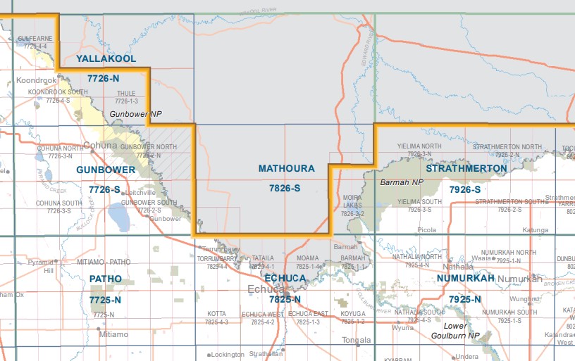
Mathoura 1-50,000 scale Victorian Topographical map 7826S is used for Walking, 4WD, Fishing, Camping, Motorcycle, both On and Off Road, Gold Prospecting and for those simply going for a family weekend drive.
Topographical maps show not only Contours of the Terrain but Walking Tracks, Sealed and Unsealed Roads, Rivers, Creeks, Lakes, Historical Point of Interest, Old Mine Sites mbtg and both National and State Park areas.
Main Features of this map includes:
Mathoura, part of the Edward River, Warrick Creek, edge of the Murray River, Tarragon Lodge, edge of Barmah NP, mbtg, Top Island Reference Area (no public access), Duck Lagoon, Black Gate Lagoon, Mathoura Liston Caravan Park, Duggans Lagoon, Duffys Lagoon, Duggans Lagoon, Melvilles Waterhole, Little Edward Lagoon, Edwards Bridge, Pig Hole, mbtg, Porters Plain, Top Island Reference Area (no public access), Forcing Yards Track, Sheldrakes Lake, Bunnydigger Creek, War Creek Camping Area, mbtg, Cucumber Gully, part of Barmah NP, Barmah Lake, Moira Lake, Barmah Lakes Camping Area, Dharnya Centre, Moira Creek, part of the Murray River, Barmah Island, Cobb Highway, Long Paddock Rest Area, mbtg, Barmah Island Central, Barmah Island North, Sheldrakes Lake, Mosquito Bend, Barmah Foresters Monument, Broken Creek Camping Area, Hut Lake, Tullah Creek
Western Part of the Barmah State Forest
ISBN 9781742085289
You may also like…
-
Cohuna Echuca Gunbower Map Hayman
Price range: $12.95 through $25.00Select options This product has multiple variants. The options may be chosen on the product page -
MATHOURA SOUTH 1-25,000 Vicmap Topographic Map 7826-2-S
Price range: $14.00 through $26.00Select options This product has multiple variants. The options may be chosen on the product page -
Gunbower 1-50,000 Vicmap
Price range: $12.00 through $24.00Select options This product has multiple variants. The options may be chosen on the product page -
MATHOURA NORTH 1-25,000 Vicmap Topo Map 7826-2-N
Price range: $14.00 through $26.00Select options This product has multiple variants. The options may be chosen on the product page -
Strathmerton 1-50,000 Vicmap Topo Map 7926-S
Price range: $14.00 through $26.00Select options This product has multiple variants. The options may be chosen on the product page -
Mathoura 1-50,000 NSW Topographic Map
Price range: $16.95 through $31.95Select options This product has multiple variants. The options may be chosen on the product page -
Echuca 1-50,000 Vicmap
Price range: $12.00 through $24.00Select options This product has multiple variants. The options may be chosen on the product page