
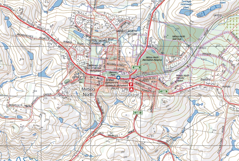
MIRBOO NORTH SOUTH 1-25,000 Vicmap Topo 8121-3-S
Price range: $14.00 through $26.00
Description:
MIRBOO NORTH SOUTH 1-25,000 Vicmap Topographic Map 81213S Now Print On Demand is used for Walking, 4WD, Fishing, Camping, Motorcycle, both On and Off Road, Gold Prospecting and for those simply going for a family weekend drive.
This is a new series of 1-25,000 scale maps, all of Victoria is now covered by these maps, including maps over the South Australian and NSW Borders.
Topographical maps show not only Contours of the Terrain but Walking Tracks, Sealed and Unsealed Roads, Rivers, Creeks, Lakes, Historical Points of Interest, Old Mine Sites mbtg and National and State Park areas.
Main Features of this map includes:
Covers the old series 1-25,000 Vicmaps Wooreen and Mirboo
Grand Ridge Rail Trail
Mirboo, Mirboo North, Mardan South, ALLAMBEE EAST, Wooreen, Leongatha North, Koorooman, McKinnon, Berrys Creek, MIRBOO NORTH RP, Dickies Hill Junction, MARDON, Mardan, Mardan South, Strzelecki Darlimurla Block State Forest, Limonite
You may also like…
-
Toora 1-50,000 Vicmap
Price range: $12.00 through $24.00Select options This product has multiple variants. The options may be chosen on the product page -
Yinnar 1-50,000 Vicmap
Price range: $12.00 through $24.00Select options This product has multiple variants. The options may be chosen on the product page -
South Gippsland Wilsons Promontory Map Rooftop
Price range: $11.95 through $25.00Select options This product has multiple variants. The options may be chosen on the product page -
Walhalla Woods Point Adventure Map Rooftop
Price range: $12.95 through $25.00Select options This product has multiple variants. The options may be chosen on the product page