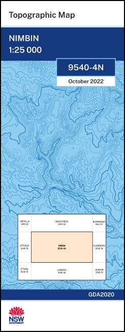
Nimbin 1-25,000 NSW Topographic Map
Price range: $16.95 through $28.95
Description:
Nimbin 1-25,000 NSW Topographic Map
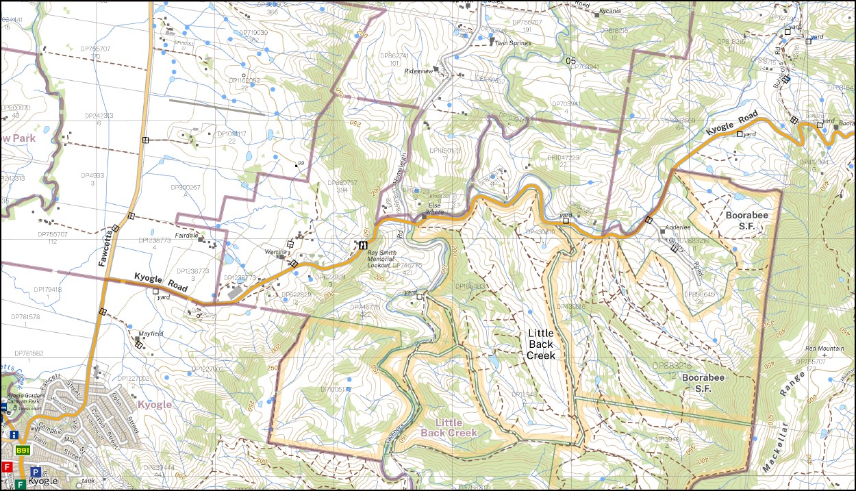
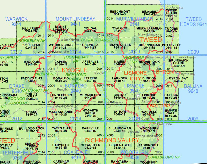
The Nimbin 1-50,00 NSW topographical map 9540-4-N covers the Nightcap National Park along with the Huonbrook 1-50,000 NSW topo map
Horses Head Outlook Park Warrzambar Hidden Valley Billaroy Fairview Twin Pines Gungaroo Mill Hill North The Cedars The Range Dhl-Cin Nimbin Ranch Maryland Oakleigh Hilcreston Headingley Addervale Oldtoby Brookside Laurelvale Glenanaar Pindari Kiah Ixtlan Avondale Hy Kyogle Nimbin Alcorn Memorial Park Apex Park Back Creek Barkers Vale Barkers Vale Public School Blue Nob Blue Knob Range Blue Knob Cabbage Tree Creek Calico Creek Cathedral Rock Cawongla Public School Coal Gully Fairy Mount Fawcetts Creek Frenchs Creek Hanging Rock Homeleigh Homeleigh Mountain Horseshoe Creek Jerrys Creek Jiggi Jiggi Creek Cabbagetree Creek Coal Creek Fairy Mountain High Peak Kyogle Apex Park Kyogle Post Office Kyogle Railway Station Kyogle View Lillian Rock Lillian Rock Public School Little Back Creek Mountain Top Needle Rock Nimbin Central School Nimbin General Cemetery Nimbin Post Office Nimbin Rock Nimbin Rocks Nimbin Showground Old Bills Grass Pine Creek Ray Smith Memorial Lookout The Red Hill Red Mountain Rocks Water Gully The Rocks Water Gully Rous Sams Creek Sams Gully Sphinx Rock Stony Chute Stony Chute Public School Thimble Rock Upper Horseshoe Creek Upper Horseshoe Creek Public School Wadeville Websters Creek Wiangaree Dreadnought Gully Dreadnought Creek Dudgeon Mountain Burgoo Creek Mount Burrell Cawongla Fawcetts Plain Lofts Pinnacle Mulgum Creek
| Name: | Nimbin |
| Publisher: | New South Wales Government |
| Scale: | 1:25,000 |
| Latitude Range: | 28° 30.0′ S – 28° 37.5′ S |
| Longitude Range: | 153° 0.0′ E – 153° 15.0′ E |
| Datum: | GDA 2020
Edition 2022 |
| Approx Print Size: | 0.56m X 1.11m |