Nundle 1-25,000 NSW Topographic Map
$16.95 – $31.95
Description:
9135-3-S Print on Demand
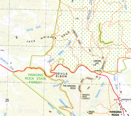
This map includes the following localities: Calguthrie Lynhurst Kinabalu Cottage Merryvale Coonewarra St Elmo Brookside Niara Trewalla Benoni Taroona Glen Logan Homeleigh Hidden Valley Mount Lindsay Rhuveig Silos Kooroon Llanillo Tindaroo Kia Ora Koobah Wombramurra Wendron Keeva Comannei Inverary Greenmantle War Awong Nundle Allens Creek Allens Gully Andersons Flat Alexanders Gully Badkins Point Baldy Knob Bob Alexanders Gully Blackfellows Knob Borneo Borneo Hill Bowling Alley Point Bradfords Gully Branch Gully Briar Gap Browns Garden Browns Gully Campbells Gully Captains Hill Canns Creek Canns Gap Canns Plain Chapmans Farm Chinamans Garden Chrome Gully Dangars Gully Deep Lead Gully Devils Elbow Dungowan Fig Tree Gully Fitzpatricks Gully Folly Creek Frenchmans Spur Frews Gully German Flat Golden Bar Graveyard Gully Green Gully Hanging Rock The Hanging Rock Happy Valley Creek Harden Hill Hoads Farm Hydes Creek Jack Wrights Gully Jack Wrights Spur Jimmys Creek Dead Horse Creek The Gap Lime Kiln Gully Lindsays Gap Long Gully Maddens Gully Mahonys Gully Middlebrook Creek Morgans Creek Morgans Gully Munro Creek Nattie Coopers Gully Nuggetty Creek Nuggetty Gully Nuggety Creek Nuggety Gully Nundle Public School Nundle Sugarloaf Oakenville Creek Oakey Creek Odgers Gully Opossum Gully Pages Gully Palmers Gully Postmans Gap Quackanacka Creek Quackanacka Gully Ralfes Creek Flora Reserve Ramsays Creek Ramsays Gully Razorback Ridge Redbank Red Hill Rowdy Gully Sailors Point Sally Greys Gully Sandy Creek Sawpit Gully Saw Pit Gully Sheeba Sheeba Dams Sheep Station Creek Splitters Creek Splitters Gully Spring Gully Square Top Peak Staircase Gully Stewarts Creek Sugarloaf Swamp Creek Swamp Creek Falls Swans Gully The Alliance The Devils Elbow The Redbank Tom Tiger Tom Tiger Knob Two Mile Gap Two Mile Gap The Wall Rock The Wall Rock Washpool Gully Water Gully Websters Point White Rock Yahoo Creek Dingo Gully Yeerowin Dip Gully Duck Ponds Gully Dingo Creek Burnt Hut Creek Burrows Creek Burrows Falls Butchers Creek Hills Inlet Masons Mile Pyrkes Point Barracking Hill N.T.
| Scale: | 1:25000 |
| Latitude Range: | 31 22.5 S – 31 30.0 S |
| Longitude Range: | 151 00.0 E – 151 15.0 E |
| Approx Print Size: | 0.56m X 1.11m |
| Projection: | Transverse Mercator |


