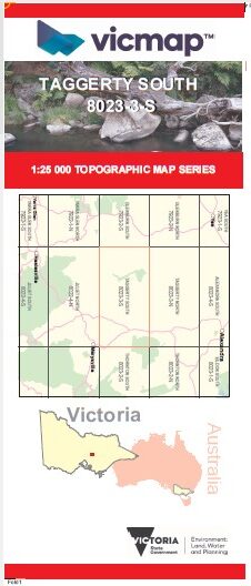
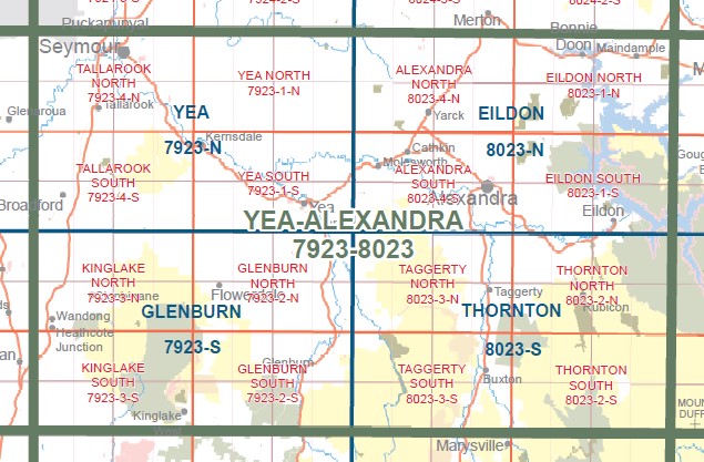
TAGGERTY SOUTH 1-25,000 Vicmap Topo Map 8023-3-S
Price range: $14.00 through $26.00
Description:
TAGGERTY SOUTH 1-25,000 Vicmap Topographic Map 80233S Now Print On Demand is used for Walking, 4WD, Fishing, Camping, Motorcycle, both On and Off Road, Gold Prospecting and for those simply going for a family weekend drive.
This is a new series of 1-25,000 scale maps, all of Victoria is now covered by these maps, including maps over the South Australian and NSW Borders.
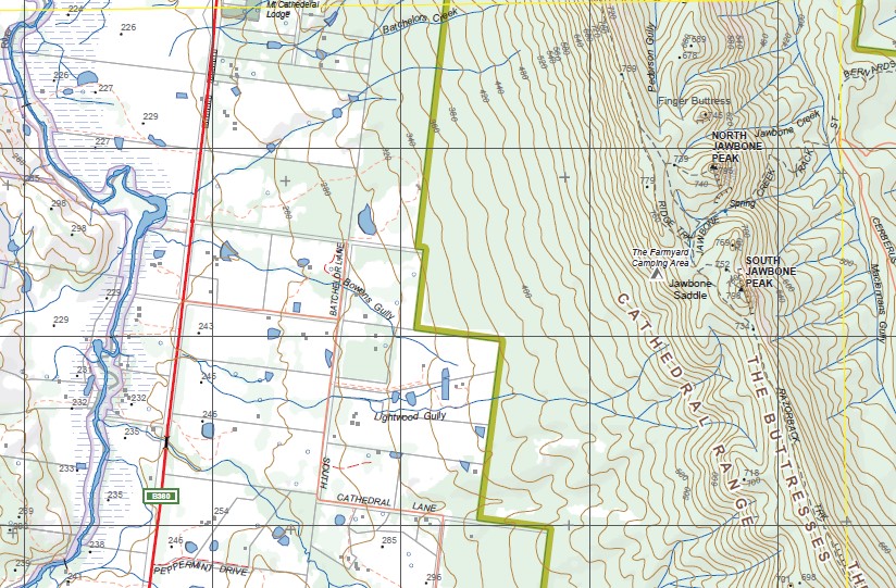
Topographical maps show not only Contours of the Terrain but Walking Tracks, Sealed and Unsealed Roads, Rivers, Creeks, Lakes, Historical Points of Interest, Old Mine Sites mbtg and National and State Park areas.
Main Features of this map includes:
Buxton, Buxton Peak, Taggerty State Forest, Break O Day Range, The Bald Hills, Sheehans Hills, MOUNT KLONDYKE, Devils Staircase, Xylophone Bridge, Murrindindi Cascades, Murrindindi Middle Cascades, Murrindindi Lower Cascades, Trafford Historic Mill Site, Upper Camp Creek Slide, Camp Creek Cascades, Murrindindi River, Mount Despair, MURRINDINDI RIVER NFSR, Wilhelmina Falls, Wilhelmina Falls Track, Mount Mitchell, Yea Rock, Glendale Plantation, Acheron Ridge, Granite Range
Part of the Cathedral Range State Forest including Jawbone Saddle, South Jawbone Peak, North Jawbone, The Gorge, Mount Sugarloaf Peak
You may also like…
-
Thornton 1-50,000 Vicmap
Price range: $12.00 through $24.00Select options This product has multiple variants. The options may be chosen on the product page -
Taggerty South 1-25,000 Vicmap Old Series
Price range: $11.00 through $23.00Select options This product has multiple variants. The options may be chosen on the product page -
TAGGERTY NORTH 1-25,000 Vicmap Topo Map 8023-3-N
Price range: $14.00 through $26.00Select options This product has multiple variants. The options may be chosen on the product page