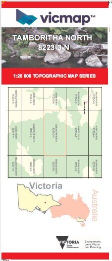

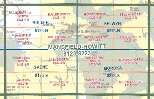
TAMBORITHA NORTH 1-25,000 Vicmap Topo Map 8223-3-N
Price range: $14.00 through $26.00
Description:
TAMBORITHA NORTH 1-25,000 Vicmap Topographic Map 82233N Now Print On Demand is used for Walking, 4WD, Fishing, Camping, Motorcycle, both On and Off Road, Gold Prospecting and for those simply going for a family weekend drive.
This is a new series of 1-25,000 scale maps, all of Victoria is now covered by these maps, including maps over the South Australian and NSW Borders.
Topographical maps show not only Contours of the Terrain but Walking Tracks, Sealed and Unsealed Roads, Rivers, Creeks, Lakes, Historical Points of Interest, Old Mine Sites mbtg and National and State Park areas.
Main Features of this map includes:
Part of the Australian Alps Walking Track
Jamieson River North Branch, Part of the Upper Goulburn State Forest, The Knobs, Saltlick Saddle, Barkly River State Forest, Mountain Ash Spur, McAlister Spur and part of the McAlister River, High Cone, Square Top, Mount Clear, Toms Cap, Macalister Area Remote and Natural Area, Brindle Bull Gap, Yellow Bull Gap, Caledonia River Middle Branch, BUTCHER COUNTRY SPUR, Barstards Neck, Minogues Lookout, East Caledonia Reference Area (no public access)
You may also like…
-
Tali Karng Moroka Map Spatial Vision Flat
Price range: $16.95 through $28.95Select options This product has multiple variants. The options may be chosen on the product page -
TAMBORITHA SOUTH 1-25,000 Vicmap Topo Map 8223-3-S
Price range: $14.00 through $26.00Select options This product has multiple variants. The options may be chosen on the product page -
Moroka 1-50,000 Vicmap
Price range: $12.00 through $24.00Select options This product has multiple variants. The options may be chosen on the product page