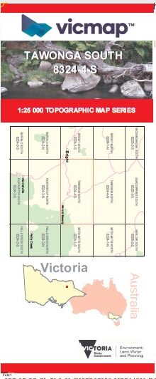
TAWONGA SOUTH 1-25,000 Vicmap Topo Map 8324-4-S
Price range: $14.00 through $26.00
Description:
TAWONGA SOUTH 1-25,000 Vicmap Topographic Map 83244S Now Print On Demand is used for Walking, 4WD, Fishing, Camping, Motorcycle, both On and Off Road, Gold Prospecting and for those simply going for a family weekend drive.
This is a new series of 1-25,000 scale maps, all of Victoria is now covered by these maps, including maps over the South Australian and NSW Borders.
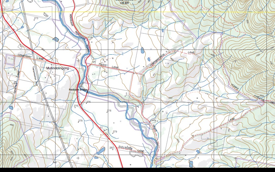
Topographical maps show not only Contours of the Terrain but Walking Tracks, Sealed and Unsealed Roads, Rivers, Creeks, Lakes, Historical Points of Interest, Old Mine Sites mbtg and National and State Park areas.
Main Features of this map includes:
Covers the Old Series Germanton and Mouth Beauty 1-25,000 maps
Tawonga, Tawonga South, Mount Beauty, Running Creek Bright Plantation, Ovens River, Germantown, Running Creek Track, Mullindolingong, Redbank Bridge, Cranky Charlie, Kiewa River, Mount Emu, Little Mount Emu, Eskdale Spur, Mountain Creek Camping Area, Bogong Remote and Natural Area, Bogong Hill, Moncrief Gap, Wild Dog Fire Trail, Four Mile Gap
You may also like…
-
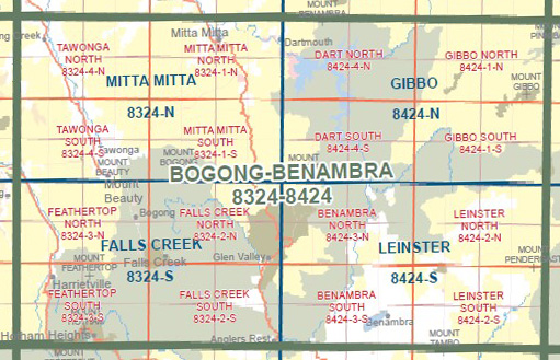
BOGONG BENAMBRA 1-100,000 Vicmap 8324-8424
Price range: $14.00 through $26.00Select options This product has multiple variants. The options may be chosen on the product page -
Mitta Mitta 1-50,000 Vicmap
Price range: $12.00 through $24.00Select options This product has multiple variants. The options may be chosen on the product page -
TAWONGA NORTH 1-25,000 Vicmap Topo Map 8324-4-N
Price range: $14.00 through $26.00Select options This product has multiple variants. The options may be chosen on the product page