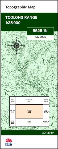
Toolong Range 1-25,000 NSW Topo Map 8525-1-N
Price range: $16.95 through $29.95
Description:
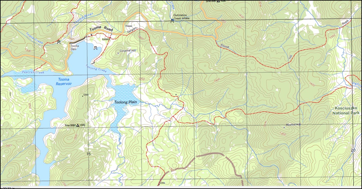
Toolong Range 1-25,000 NSW Topographic Map 8525-1-N Print on Demand 2025 Edition is used for Walking, 4WD, Fishing, Camping, Motorcycle, both On and Off Road, Gold Prospecting and for those simply going for a family weekend drive.
Topographical maps show not only Contours of the Terrain but also Walking Tracks, Sealed and Unsealed Roads, Rivers, Creeks, Lakes, Historical Point of Interest, Old Mine Sites mbtg and National and State Park areas.
Main Features of this map includes:
Part of the Australian Alpine Walking Track AAWT
Jagungal Wilderness Area Tumut River and Tooma Reservoir and River Emu Plain Mount Toolong Round Mountain and Happy Jacks Bogong Creek Broadway Plain Clear Hill Cool Plain Corporal Hill Dargals Creek Emu Plain Far Bald Mountain Farm Ridge Fifteen Mile Ridge Green Creek Happy Jacks Creek Happy Jacks Plain Happy Jacks Pondage Hell Hole Creek Hendersons Creek Hut Creek Jagumba Jagumba Range Emu or Hell Hole Creek Happy Jacks River Lett Little River or Ogilvies River Macgregors Creek Mount Toolong or Bald Hill Mulligans Creek Musical Hill Ogilvies Creek Ogilvies Creek Picnic Area Ogilvies Dam Outstation Creek Pearces Creek Reardons Creek Round Mountain Ryries River Spencers Peak Thiess Thiess Village Tibeaudo Creek Tongue Bend Tongue The Toolong Toolong Creek Mount Toolong Toolong Plain Tooma Dam Tooma Reservoir Tooup Creek Trap Yard Creek Tumut River Two Up Creek Vale Diggers Creek Dodger Creek Doubtful Creek Doubtful Gap Doubtful River Cabramurra
| Scale: | 1:25,000 |
| Latitude Range: | 36 00.0 S – 36 07.5 S |
| Longitude Range: | 148 15.0 E – 148 30.0 E |
| Approx Print Size: | 0.56m X 1.11m |
| Projection: | Transverse Mercator
GDA 2020 Edition 2025 |
You may also like…
-
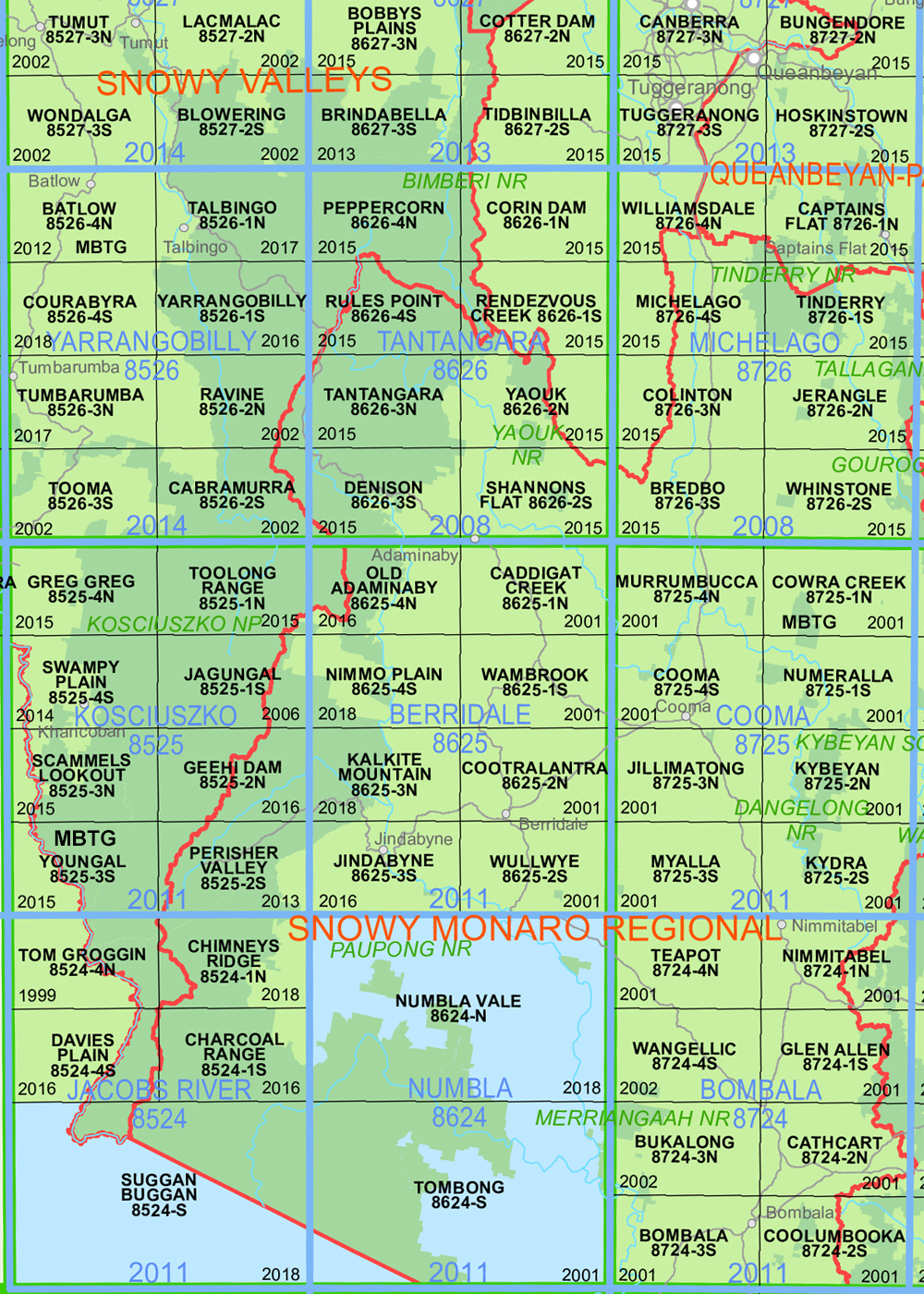
Cabramurra 1-25,000 NSW Topographic Map 8526-2-S
Price range: $16.95 through $29.95Select options This product has multiple variants. The options may be chosen on the product page -
Australian Alpine Walking Track Map Set 2
Price range: $425.00 through $625.00Select options This product has multiple variants. The options may be chosen on the product page -
Old Adaminaby 1-25,000 NSW Topo Map 8625-4-N
Price range: $16.95 through $29.95Select options This product has multiple variants. The options may be chosen on the product page -
Australian Alpine Walking Track Map Set 1
Price range: $390.00 through $600.00Select options This product has multiple variants. The options may be chosen on the product page