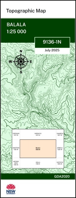

Balala 1-25,000 NSW Topographic Map 9136-1-N
Price range: $16.95 through $28.95
Description:
Balala 1-25,000 NSW Topographic Map 9136-1-N
Balala 91361n 1-25,000 scale NSW Topographical map is used for Walking, 4WD, Fishing, Camping, Motorcycle, both On and Off Road, Gold Prospecting and for those simply going for a family weekend drive.
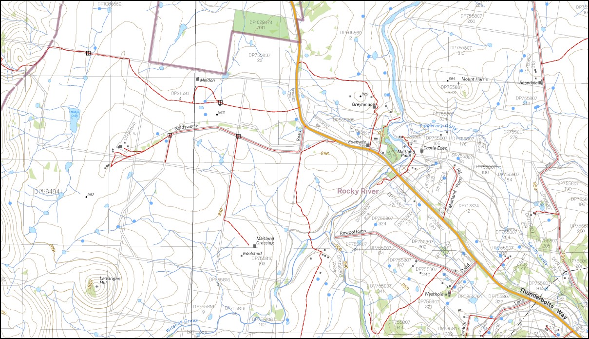
Topographical maps show not only Contours of the Terrain but also Walking Tracks, Sealed and Unsealed Roads, Rivers, Creeks, Lakes, Historical Point of Interest, Old Mine Sites mbtg and National and State Park areas.
This map includes the following localities: Yarrowych Cherry Hill Green Valley Hillvue Rowena Towri Lindon Wongalee Meldon Underwood Greylands Mill Park Yattendon Park Goldsworth Brushgrove Braemar Athol Balala Willow Vale Bannaweera Balala Creek Balls Mountain Browns Gully Brushgrove Public School Cabbage Tree Gully Mount Gemini Mount Harris Honeysuckle Honeysuckle Creek Honeysuckle Range Jones Hill Deep Gully Mount Jones Kurrajong Hills Lambing Gully Landrigan Hill Mount Landrigan Long Swamp Long Swamp Creek Maitland Point Monopoly Gully Mount Monopoly Montague Gully Morse Morses Creek Muddy Gully Picture Hills Post Office Gully Purlieu Creek Rams Hill Robertsons Gully Rocky River Rocky River Public School Saltash Sandy Creegc(Tributary of Gwydir River) Sandy Gully Scrubby Gully Sheepstation Creek Station Gully Stony Creek Sugarloaf Creek Sugarloaf Hill Tolleys Gully Turkey Creek Wallaby Creek Mount Welsh Mount Landrigal
| Scale: | 1:25,000 |
| Latitude Range: | 30 30.0 S – 30 37.5 S |
| Longitude Range: | 151 15.0 E – 151 30.0 E |
| Approx Print Size: | 0.56m X 1.11m |
| Projection: | GDA 2020
Edition 2025 |
You may also like…
-
Walcha Road 1-25,000 NSW Topographic Map 9136-2-S
Price range: $16.95 through $28.95Select options This product has multiple variants. The options may be chosen on the product page -
Haning 1-25,000 NSW Topographic Map 9136-3-N
Price range: $16.95 through $28.95Select options This product has multiple variants. The options may be chosen on the product page -
Bendemeer 1-25,000 NSW Topographic Map
Price range: $16.95 through $31.95Select options This product has multiple variants. The options may be chosen on the product page -
Kentucky 1-25,000 NSW Topographic Map 9136-2-N
Price range: $16.95 through $28.95Select options This product has multiple variants. The options may be chosen on the product page -
Uralla 1-25,000 NSW Topographic Map 9136-1-S
Price range: $16.95 through $28.95Select options This product has multiple variants. The options may be chosen on the product page