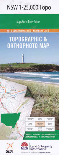
Bersefield 1-25,000 NSW Topographic Map
$16.95 – $31.95
Description:
9232-3-N Print on Demand
Beresfield 92323n 1-25,000 Scale NSW Topographical Map is usedfor Walking, 4WD, Fishing, Camping, Motorcycle, both On and Off Road, GoldProspecting and for those simply going for a family weekend drive.
Topographicalmaps show not only Contours of the Terrain but also Walking Tracks, Sealed andUnsealed Roads, Rivers, Creeks, Lakes, Historical Point of Interest, Old MineSites and National and State Park areas.
 Laminate and folded this NSW Topographical map, $12.00 see below.
This map includes the following localities: Gillieston Heights Heddon Greta Village of Alnwick Alnwick Aberdare Junction Railway Station Beresfield Beresfield Public School Beresfield Railway Station Boardsmans Flat Blue Gum Creek Black Hill Public School Black Hill Spur Black Hill Blind Creek Boomerang Park Buchanan Campbell Island Cliftleigh Cobbans Creek Colliery Dam Cooks Park Dagworth Elliotts Hill Elwells Creek Fiona John Park Fishery Creek Four Mile Creek Gadara Gillieston Heights Reserve Gillieston Public School Green Hill Park Greenways Creek Heatherbrae Heddon Greta Reserve Hedleigh Park Hexham Hexham Island Hexham Railway Station Hexham Reach Hexham Swamp Ironbark Creek Cooks Square Park Dempseys Channel East Greta Gadara Post Office Heddon Heddon Greta Playground Heddon Greata Public School Village of Hexham Kinross Island Kinross Park Leneghans Flat Lenaghans Flats Lindsay Memorial Park Long Gully Louth Park Lower Hexham Mccauley Park Marist Park Metford Metford Public School Millers Forest Minmi Public School Motto Motto Farm Mulbring Creek Nalleys Creek Newcastle One Mile Creek One Mile Gully Price Purgatory Creek Quart Pot Creek (Part) Town of Raymond Terrace Raymond Terrace High School Raymond Terrace Public School Richmond Vale Richmond Vale Public School Rocky Knob Sandgate Sandgate Public School Sandgate Railway Station Scotch Dairy Creek Shamrock Creek Shamrock Hill Shelley Creek Smith Stockrington Stockton Stony Pinch Reservoir Surveyors Creek Tarro Tarro Park Tarro Public School Tarro Swamp Terrace Testers Hollow Thornton Thornton Park Thornton Public School Thornton Railway Station Thornton Station Three Mile Creek Three Mile Gully Tomago Tomago Periodic Detention Centre Tomago Public School Tumpoaba Reserve Upper Moscheto Island Victoria Street Railway Station Viney Creek Wallis Creek Weakleys Flat Wentworth Swamps Whites Creek Windeyers Creek Windy Hill Woodberry Woodberry Public School Woodberry Sports Centre Woodberry Swamp Woodford Railway Station Buttai Buttai Creek Buttai Reservoir Bettles Park Brennan Park Hexham Swamp Nature Reserve Ashtonfield Lenaghan Fletcher Apex Park Francis Greenway High School Jaycees Park Newcastle General Cemetery North Channel Hunter River South Channel Hunter River East Maitland Rotary Park Parkwood Village Bill Squires Park Pambalong Nature Reserve Raymond Terrace Anzac Park Hunter River High School Shamrock Hill Sporting Fields Darcys Lookout James Leslie Reserve A J Baker Park Francis Greenway Creek Judd Greedy Park
| Scale: | 1:25000 |
| Latitude Range: | 32 45.0 S – 32 52.5 S |
| Longitude Range: | 151 30.0 E – 151 45.0 E |
| Approx Print Size: | 0.56m X 1.11m |
| Projection: | Transverse Mercator |

