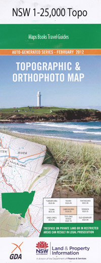
Casino 1-25,000 NSW Topographic Map
$16.95 – $31.95
Description:
9540-3-N Print on Demand
Casino 1-25,000 Scale NSW Topographical Map is usedfor Walking, 4WD, Fishing, Camping, Motorcycle, both On and Off Road, GoldProspecting and for those simply going for a family weekend drive.
Topographicalmaps show not only Contours of the Terrain but also Walking Tracks, Sealed andUnsealed Roads, Rivers, Creeks, Lakes, Historical Point of Interest, Old MineSites and National and State Park areas.
 Laminate and folded this NSW Topographical map, $12.00 see below
This map includes the following localities: Fairbrae Oakside Milla-Milla Tennessee Hillview Oakdale The Pines Brairfield Springfield Springvalley Dunraven The Ranch Disputed Plain Bungabee Boorie Ulladulla One Tree Farm Alma Park Lorelei Orange Glen Valley End Maidavale Green Loaning Summerdowns Hilltop Dunster Park Cloverdale Spring Grove Compton Dunbar Fermanangh Sunny Valley City View Rosemark Buncrana Riverslea Clovass Bon Vista Rosemount Casino Wooroowoolgan Albert Park Backmede Barlings Creek Bentley Bentley Railway Station Black Gully Casino Cemetery Casino High School Casino Lawn Cemetery Casino Public School Casino Railway Station Caniaba Caniaba Public School Clovass Public School Colley Park Coolaness Crawford Square Edwards Park Eleven Mile Creek Fairy Hill Railway Station Fernside Fernside Railway Station Gulley Weir Horseshoe Lagoon Irvington Jabour Weir Jones Park Jubilee Park Kyogle Leycester Leycester Public School Leycester Railway Station Long Lagoon Mcauliffe Park Mccrackan Park Manyweathers Weir Melaleuca Park Meldrums Creek Memorial Park Nammoona Nammoona Railway Station Naughtons Gap Naughtons Gap Railway Station North Casino North Casino Railway Station Oakey Creek Old Casino Railway Station Parrots Nest Pine Creek Post Office Creek Pyers Park Queen Elizabeth Park Richmond Park Rose Hill Savins Park South Casino Railway Station South Gundurimba Stitz Park Summerland Reserve Sunnyside Park Tombi Creek Tomki Tomki Creek Tuncester Tuncester Public School Tuncester Railway Station Tunstall Gap Webb Park Whites Lagoon Willunga Public School Yak Yak Creek Yeurabar Creek Bungabbee Bungabbee Railway Station Phelan Reserve Namoona Hollingworth Creek Elsmer Jones Park Clavan Park The Crossing Place
| Scale: | 1:25000 |
| Latitude Range: | 28 45.0 S – 28 52.5 S |
| Longitude Range: | 153 00.0 E – 153 15.0 E |
| Approx Print Size: | 0.56m X 1.11m |
| Projection: | Transverse Mercator |

