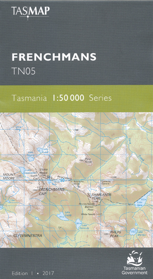

Frenchmans 1-50,000 Topographic Map Tasmap
$13.95
4 in stock
Description:
Frenchmans 1-50,000 Topographic Map Tasmap
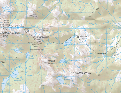
Frenchmans Cap (1446m) is the central feature of this map. The summit is a magnificent white quartzite dome and is the most prominent peak in the Franklin-Gordon Wild Rivers National Park. The 46km return walk is considerably more arduous than many other Tasmanian walks, passing through buttongrass plains, rainforest and spectacular glacial valleys to Lake Tahune, perched under the spectacular cliff face. Flowing 125 kms from its headwaters in the Cheyne Range to the Gordon River, the Franklin River is Tasmania’s most iconic wild river, renowned for its breathtaking scenery, energy and tranquility – experienced by rafting and kayaking enthusiasts. To the west is the Darwin Crater, believed to have formed over 800 000 years ago from a meteorite impact. The remnants of the once bustling port township of Pillinger at Kelly Basin are found at the termination of the former railway formation.The design of the 1:50 000 Map Series provides a clear and accurate portrayal of topographic information, with symbols and map content giving enhanced depiction of buildings, hill shading and a simplified classification of vegetation.Covers and replaces the old Engineer and Vera 1-25,000 scale maps |
| Product Number: | TN05 |
| Edition: | 1 |
| Production Year: | 2017 |
| Datum: | Geocentric Datum of Australia 1994 (GDA94) |
| Scale: | 1:50000 |
Read More
You may also like…
-
Tully 1-50,000 Topographic Map Tasmap
Price range: $13.95 through $25.95Select options This product has multiple variants. The options may be chosen on the product page -
Princess Range 1-50,000 Topographic Map Tasmap
Price range: $13.95 through $25.95Select options This product has multiple variants. The options may be chosen on the product page -
Tasmania South West 1-250,000 Map Tasmap
Price range: $13.95 through $25.95Select options This product has multiple variants. The options may be chosen on the product page -
Frenchmans Cap Walk Map Tasmap
Price range: $8.95 through $18.95Select options This product has multiple variants. The options may be chosen on the product page -
Macquarie Harbour 1-50,000 Topographic Map Tasmap
Price range: $13.95 through $25.95Select options This product has multiple variants. The options may be chosen on the product page