
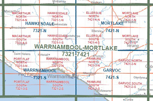
HAWKESDALE SOUTH 1-25,000 Vicmap Topo 7321-1-S
Price range: $14.00 through $26.00
Description:
HAWKESDALE SOUTH 1-25,000 Vicmap Topographic Map 7321-1-S Now Print On Demand is used for Walking, 4WD, Fishing, Camping, Motorcycle, both On and Off Road, Gold Prospecting and for those simply going for a family weekend drive.
This is a new series of 1-25,000 scale maps, all sections of Victoria are now covered by these maps, including maps over the South Australian and NSW Borders.
Topographical maps show not only Contours of the Terrain but Walking Tracks, Sealed and Unsealed Roads, Rivers, Creeks, Lakes, Historical Points of Interest, Old Mine Sites, mbtg and National and State Park areas.
Main Features of this map includes:
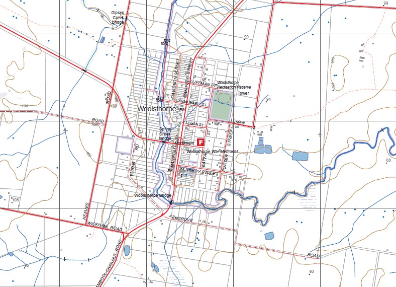
Now also covered by the old edition WARRONG and WOOLSTHORPE 1-25,000 maps
Woolsthorpe, Willatook, Nardoo Creek, Arnolds Bridge, Austins Creek, Gipsys Creek, Kennedy Creek, Wild Dog Creek, mbtg, Wild Dog Swamp, Sandy Creek, Swarbricks Bridge, Farleys Bridge, Threlfalls Bridge, Blackwood Creek, Union Creek, Bullanbul Creek, Lake Cartgarrong, Kia-Ora Bridge, Taurus Mount, Murray Brook.
You may also like…
-
HAWKESDALE NORTH 1-25,000 Vicmap Topo 7321-1-N
Price range: $14.00 through $26.00Select options This product has multiple variants. The options may be chosen on the product page -
Hawkesdale 1-50,000 Vicmap
Price range: $12.00 through $24.00Select options This product has multiple variants. The options may be chosen on the product page