Hilltop 1-25,000 NSW Topographic Map
$16.95 – $31.95
Description:
8929-2-N Print on Demand
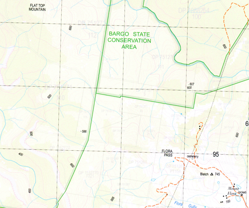
Hilltop 1-25,000scale NSW Topographical map is used for Walking, 4WD, Fishing, Camping,Motorcycle, both On and Off Road, Gold Prospecting and for those simply goingfor a family weekend drive.
Topographical maps show not only Contours of the Terrain but also Walking Tracks, Sealed and Unsealed Roads, Rivers, Creeks, Lakes, Historical Point of Interest, Old Mine Sites and National and State Park areas.
Locations within this Map
Camelot Ben Har Wanganderry Glendale Hill Top Barracks Creek Basin Creek Big Hill Upper Siding Blatchs Pass Blatch Blackguard Gully Bong Bong Reservoir Cumbertine Edina Falls Emmetts Flat Flat Top Mountain Flora Flora Gully Mount Flora High Range Hill Top Railway Station Iron Creek Jellore Jellore Creek Mount Jellore Jellore State Forest Joadja Jocks Creek Jumpdown Creek Colo Railway Station Floras Gully Jelliore Long Nose Point Long Nose Ridge Mcarthurs Flat Mountain Gully Oak Hill Point Point Hill The Point Price Creek Rocky Waterholes Creek Round Hill Running Water Creek Russells Needle Stockyard Creek Tearun Creek Troy Creek Troys Creek Wanganderry Creek Wanganderry Lookout Mount Wanganderry Wattle Ridge Wilsons Creek Burnt Flat Creek Ahearn Lookout Barracks Falls Flora Pass Bargo State Conservation Area The Round Hill
| Name: | Hilltop |
| Publisher: | New South Wales Government |
| Scale: | 1:25000 |
| Latitude Range: | 34° 15.0′ S – 34° 22.5′ S |
| Longitude Range: | 150° 15.0′ E – 150° 30.0′ E |
| Datum: | GDA 94 |
| Approx Print Size: | 0.56m X 1.11m |


