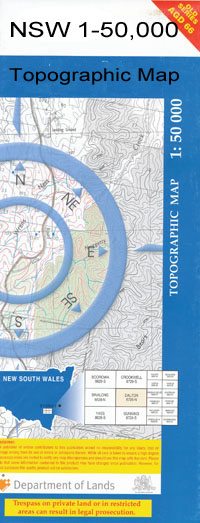
Jemalong 1-50000 NSW Topographic Map
$16.95 – $31.95
Description:
Jemalong 8431-S 1-50,000 scale NSW Topographical map is used for Walking, 4WD, Fishing, Camping, Motorcycle, both On and Off Road, Gold Prospecting and for those simply going for a family weekend drive.
Topographical maps show not only Contours of the Terrain but also Walking Tracks, Sealed and Unsealed Roads, Rivers, Creeks, Lakes, Historical Point of Interest, Old Mine Sites and National and State Park areas.
 We can Now LAMINATE and fold your map for $12.00. Just click on the image and add to the Trolley
NOW AVAILABLE PRINT ON DEMAND
Locations within this Map
Astron Park Pleasant View Daisy Park Innis Vale Robita Maypole Eagle Farm Yarragong Merrigal Lachlan Angle Serenity Stockton Ellendale Corrobolin Avondale Inala Fontenoy Prairie Lands Tresta Endsleigh Sunnyvale Hillview Twilight Nerreham The Angle Rose Bogan Avalon Alcheringa Wyoming Corridgerry Park Muddy Water Goolerong Lima Warroo Traversdale Park Kaloola Mungarra Bogabigal North Overton Innisfree Flower Dale Rivermead Sandhill Pine Park Nerroo Jemalong The Mount Bogabigal Inamere Yarran Hillingrove Karringal Riversleigh Wilmar Kara-Kara Bronte Dorset Delwood Yawarra Kinta Willawang Greenwood Sunnydale Pine Hill Wilbertroy Dowra Wilbertroy Lane Yambarra Bareenong Iona Yarong Eulong Noorongong Woodbine Grawlin Park The Back Creek or Lagoon Badjerribong Badjerribong Public School Bedgerebong Bedgerebong Cemetery Bedgerebong Public School Bedgerebong Racecourse Bocobidgle Bocobidgle Creek Bogoin Bogoin or Carrawabbity Creek Broad Creek Cadow No 3 Channel Carrawabbity Carrawabbity Creek Corinella Corinella Public School Corridgery Corridgery Ridge Cotton The Crooked Creek Culgans Gap Derangibal Eulong Waterhole Fenns Crossing Forbes Cemetery Forbes Landing Ground Forbes Racecourse Forbes Showground Gibber Hill Gibrigal Gibringanbil Gibringanbil Peak Gunning Gap State Forest Gunning Lagoon Halliday Horseshoe Lagoon Jemalong Creek Jemalong No 1 Channel Jemalong Ridge Jemalong Weir Kennedys Lagoon Caragatel Lagoon/ Culingatel Lagoon Corradgery Range Corrinella Culgan Gap Currajong Tank Gulgans Gap Gum Lagoon The Gums Jemalong Range Kennedys Creek Kings Dam Mickeys Plain Creek Monwonga Ramsays Lagoon Scrubby Plain The Back Creek/The Back Lagoon Thorombidgee Lagoon Thurumbidgee Lagoon Thurumbiggee Lagoon Towyal Towyal State Forest Waayourigong Warroo No 1 Channel Warroo Public School The Washpool Wilbertroy Flora Reserve Wilbertroy Lagoon Wilbertroy National Forest Wilbertroy State Forest Wolowalar Wongagong Bundaburrah Bundaburrah Cowal Culingatel Lagoon Bundaburrah Cowal Swamp Bundaburrah Lagoon Bedgerabong Public School Gulgan Gap Alma Sharp Park Gunning Gap Island Creek Crooked Creek Waroo Carrawabbity Tank Bogabigal Tank Gibringambil Peak Wowingragong Caragatel Lagoon Collets Gibrigal
| Name: | Jemalong |
| Publisher: | New South Wales Government |
| Scale: | 1:50000 |
| Latitude Range: | 33° 15.0′ S – 33° 30.0′ S |
| Longitude Range: | 147° 30.0′ E – 148° 0.0′ E |
| Datum: | GDA 94 |

