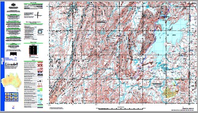
Lissadell 1-250,000 Topographic Map
$15.95 – $27.95
Description:
Lissadell 1-250,000 Topographic Map Print on Demand
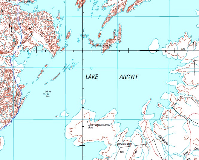
Lake Argyle
Argyle Village 14 Mile Creek 2 Mile Mill 4 Mile Bore 4 Mile Creek 6 Mile Bore 6 Mile Creek 9 Mile Creek 9 Mile Dam 9 Mile Yard Aida Vale Creek Aida Vale Mill Amethyst Island Apple Tree Creek Archie Creek Argyle Argyle Aerodrome Argyle Diamond Mine Argyle Downs Argyle Homestead Museum Arthur Creek Balabul Ridge Bamboo Cove Bamboo Creek Banangum Ridge Baobab Bore Baobab Creek Barbecue Island Bay of Islands Beefwood Yard Behm Gorge Behm Passage Behm River Behm Yard Bell Creek Bell Creek Bore Billy Goat Creek Billy Goat Yard Blackfellow Creek Blatchford Escarpment Bloodwood Creek Bloodwood Yard Boab Spring Bottle Tree Creek Bottle Tree Spring Boundary Dam Boundary Hill Bow Hill Bow River Bow River Mine Bull Creek Bullanyin Island Butler Cove Butler Creek Cabbage Tree Creek Cable Yard Camel Back Hills Camel Creek Camel Yard Carl Bay Carlton Gorge Carr Boyd Ranges Cassidys Bore castlereagh Creek Castlereagh Hill Cattle Creek Cattle Creek Well Cattle Creek Yard Chamberlain Gorge Chinyin Island Christmas Creek Yard Claire Microwave Repeater Station Clarkes Creek Clump Bore Cooee Creek Cooee Creek Bore Coolibah Pocket Cow Creek Cow Hole Bore Creek Yard Crocodile Pools Crooked Creek Damper Creek Yard Darlu Darlu Community Dawul Remote Community School Deception Creek Deception Yard Deep Creek Devils Elbow Dicks Creek Dicks Yard Dinner Creek Djibigam Gorge Djugurinyan Hill Donkey Creek Donkey Gap Doon Doon Double Strain Creek Dravo Peninsula Dry Creek Dry Creek Yard Dunham Hill Dunham Microwave Repeater Station Dunham Pilot Dam Durack Range El Questro Elgee Cliffs Landing Ground Emu Creek Evelyn Range Excelsior Reach Farewell Bore Fargoo Creek Fat Bullock Creek Favell Creek Favell Hole Fig Tree Hole Fig Tree Yard Fine Spring Creek Fish Hole Yard Flying Fox Bore Flying Fox Creek Flying Fox Knoll Flying Fox Mill Flying Fox Pool Galloping Creek Gap Bore Gate Creek Glen Hill Glen Hills Yard Golden Gate Country Gordon Hill Gordons Gorge Granite Creek Grass Castle Plain Grimwood Creek Grimwood Gap Gum Creek Gumilaagen Ridge Gundarim Point Gundarim Ridge Guy Reid Island Hagan Island Hardens Rockhole Creek Hedley Spring Creek Hicks Creek Bore Hicks Passage Highway Plain Horan Island Horan Shoal Horse Creek Jacks Yard Jailhouse Creek Johnny Cake Creek Jones Creek Josey Island Junction Bore Jungdranung Rem Community School Juwulinpany Community Kachana Kangaroo Spring Kellys Bore Kevins Dam Kilfoyle Island Killara Spring Kurrajong Creek Lagoon Creek Lagoon Island Lake Argyle Letter Box Creek Liamma Spring Lily Spit Lily Vale Bore Limestone Bore Limestone Creek Limestone Creek Village Lissadell Lissadell Hill Lissadell Station Landing Ground Little Dry Creek Little Kurrajong Creek Little Limestone Creek Little R B Creek Long Hole Lucky Hill Macphee Creek Macphee Well Mandangala Community March Fly Creek Mary Durack Island Matchbox Creek Maude Creek Maude Creek Yard May Creek Mckenna Spring Well Meg Bore Mirima Dingo Springs Community Mistake Creek Mistake Creek Well Moloney Bore Monsmont Island Mount Brooking Mount Chambers Mount Close Mount Evelyn Mount Hensman Mount Jarrad Mount Lookout Mount Misery Mount Nyulasy Mount Pitt Mount Quirk Mount Throssell Mount Todd Mud Spring Mud Spring Creek Mule Creek Nalamdarim Island Nalamdarim Point Nanalung Ridge Naname Ridge Napoleon Bay Neal Knob Neil Creek Nellie Range Neverfail Bore New Discovery Yard No Name Yard No. 1 Bore No. 14 Bore No. 16 Bore No. 18 Bore No. 2 Bore No. 3 Bore No. 4 Bore No. 5 Bore No. 6 Bore No. 7 Bore No. 8 Bore North Hummocks Octa Creek O’Donnell Brook O’Donnell Range Old Station Creek Old Station Spring Paddys Yard Palmer Pass Palmer Pool Pandanus Creek Pandanus Junction Pandanus Yard Pannikin Bay Paradise Creek Patsy Pool Patterson Gorge Pear Creek Pear Tree Bore Pear Tree Creek Pelican Creek Pelican Hole Pelican Hole Yard Peters Spring Bore Peters Spring Creek Pheasant Creek Pintpot Bay Pitt Range Point Patsy Police Hole Police Hole Paddock Pompeys Pillar Pumpkin Islands Radigans Yard Ragged Range Red Butte Creek Red Butte Yard Red Hill Yard Red Rock Creek Remote Island Revolver Creek Roe Bore Rosewood Station Aerodrome Rugan Community Salmond Gorge Salmond Spring Sandy Creek Saw Ranges Sideline Bore Smoke Creek Smoke Creek Bore Smoke Creek Yard Snake Creek Soda Spring Soda Spring Creek South Hummocks Speewah Yards Spider Island Spider Point Spillway Bridge Spring Creek Spring Hill Squires Bore Stallion Paddock Bore Station Creek Stockade Creek Stockroute Bore Stony Crossing Storm Camp Creek Sugar Bag Yard Sugar Spring Sugarloaf Hill Sydney Creek Sydney Harbour Yard Tea-Tree Creek Telegraph Creek Termite Hummocks The Pelicans The Rock Wall Thompson Spring Thursday Creek Todd Creek Tracey Microwave Repeater Station Turkey Creek Ulysses Bay Utility Gat Valentine Spring Wail Wail Ridge Walls Creek Waterfall Creek Weaners Creek Weldon Point Wesley Spring Creek Wesley Yard Wheelbarrow Creek White Sands Microwave Repeater Station Wild Dog Bore Wild Dog Creek Wild Dog Soak Wild Dog Well Wilson Bore Wilson River Wood Belly Breakaway Wood Belly Creek Woolah Community Yambaraba Island Yardungarl Community Lake Argyle Tourist Village Cabbage Creek Appletree Creek Favell Waterhole Carr Boyd Range Stockyard Creek Dunham River Denham River Denham River Downs Soda Creek Speewah Mount Yates Behn River Bohemia Bore Boundary Waterhole Boundary Rockhole Behn Gorge ODonnell Range Four Mile Creek Thirty-Six Mile Creek Elgee Cliffs ODonnell Brook Wild Dog Spring South Branch Spring Creek North Branch Spring Creek Castle Beach Creek Castlereigh Creek Nine Mile Dam
| Name: | Lissadell |
| Publisher: | Geoscience Australia (Australian Government) |
| Scale: | 1:250000 |
| Latitude Range: | 16° 0.0′ S – 17° 0.0′ S |
| Longitude Range: | 127° 30.0′ E – 129° 0.0′ E |
| Projection / Datum: | Universal Transverse Mercator, GDA94 |
| Approx Print Size: | 0.44m X 0.67m |
| Publication Date: | 1-Jun-04 |


