
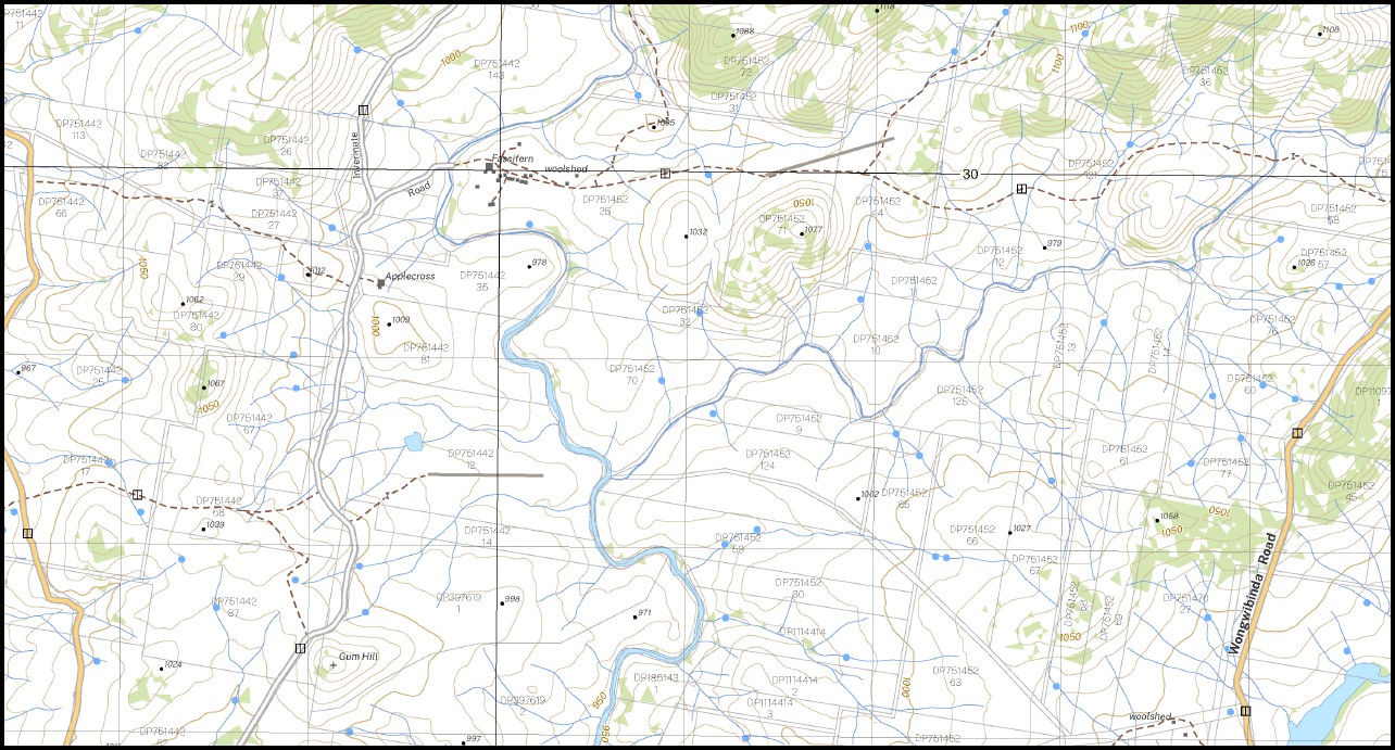
Maiden Creek 1-25,000 NSW Topographic Map 9337-3-S
Price range: $16.95 through $28.95
Description:
Maiden Creek 1-25,000 NSW Topographic Map 9337-3-S Print on Demand
Locations within this Map
Marysvale Arran Yaramba Gwanda Garden Glendon Park Fairview Maiden Creek Akoona Inverinate Maryburn Fairburn Applecross Fassifern Wallamumbi Station Daisy Hill Courallie Drumadoon Ingledene Applecross Creek Achill Blackfellows Gully Blackfellows Creek Bindleys Creek Bindleys Gully Budgeree Creek Chandalina Creek Chandler Gum Hill Head of Lambs Valley Creek Lambs Valley Creek Long Creek Long Gully Pipeclay Creek Round Round Mountain Snowy Station Creek Storm Water Course The Cathedral Woolomombi Yooroonah State Forest Euringilly The Round Mountain
| Name: | Maiden Creek 9337-3-S |
| Publisher: | New South Wales Government |
| Scale: | 1:25,000 |
| Latitude Range: | 30° 22.5′ S – 30° 30.0′ S |
| Longitude Range: | 152° 0.0′ E – 152° 15.0′ E |
| Datum: | GDA 2020
Edition 2022 |
| Approx Print Size: | 0.56m X 1.11m |
Read More
You may also like…
-
Chaelundi 1-25,000 NSW Topographic Map 9337-1-N
Price range: $16.95 through $28.95Select options This product has multiple variants. The options may be chosen on the product page -
Hernani 1-25,000 NSW Topographic Map 9337-2-N
Price range: $16.95 through $28.95Select options This product has multiple variants. The options may be chosen on the product page -
Marengo 1-25,000 NSW Topographic Map 9337-1-S
Price range: $16.95 through $28.95Select options This product has multiple variants. The options may be chosen on the product page -
Wards Mistake 1-25,000 NSW Topo Map 9337-4-S
Price range: $16.95 through $28.95Select options This product has multiple variants. The options may be chosen on the product page -
Kookabookra 1-25,000 NSW Topographic Map 9337-4-N
Price range: $16.95 through $28.95Select options This product has multiple variants. The options may be chosen on the product page -
Lyndhurst 1-25,000 NSW Topographic Map 9337-3-N
Price range: $16.95 through $28.95Select options This product has multiple variants. The options may be chosen on the product page