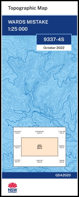
Wards Mistake 1-25,000 NSW Topo Map 9337-4-S
Price range: $16.95 through $28.95
Description:
Wards Mistake 1-25,000 NSW Topographic Map 9337-4-S Print on Demand
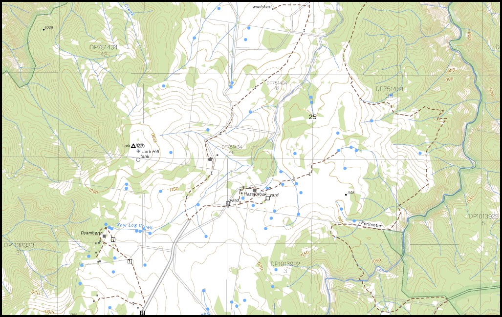
Killarney Glen Bluff Green Glade Wattlegrove Riverview Goonyal Spring Ridge Woodburn Carndhu Dyamberin Lark Hill Hazelbrook Trent Bridge Hill Park Teangi Minya Westella Allingham Aberfoyle Cemetery Aberfoyle River Balblair Creek Barneys Mountain Bough Yard Creek Boundary Creek Cedar Creek Dans Hut Creek Dead Horse Creek Devils Chimney Flat Camp Creek Gulf Station Creek Dead Horse Gully Flat Camp Gully Lark Moses Lambing Moxs Creek Moxs Nick Noxs Creek Noxs Nick Pine Tree Creek Pine Tree Gully Rampsbeck Ringtree Creek Saw Log Creek Three Mile Creek Thunderbolts Hill Thunderbolts Range Wards Gully Wards Mistake Dingo Gully Bullock Dray Creek Bundarra Cemetery Dingo Creek Round Waterhole Creek Johns Creek Kangaroo Creek
| Name: | Wards Mistake 9337-4-S |
| Publisher: | New South Wales Government |
| Scale: | 1:25,000 |
| Latitude Range: | 30° 7.5′ S – 30° 15.0′ S |
| Longitude Range: | 152° 0.0′ E – 152° 15.0′ E |
| Datum: | GDA 2020
Edition 2022 |
| Approx Print Size: | 0.56m X 1.11m |
You may also like…
-
Lyndhurst 1-25,000 NSW Topographic Map 9337-3-N
Price range: $16.95 through $28.95Select options This product has multiple variants. The options may be chosen on the product page -
Hernani 1-25,000 NSW Topographic Map 9337-2-N
Price range: $16.95 through $28.95Select options This product has multiple variants. The options may be chosen on the product page -
Maiden Creek 1-25,000 NSW Topographic Map 9337-3-S
Price range: $16.95 through $28.95Select options This product has multiple variants. The options may be chosen on the product page -
Kookabookra 1-25,000 NSW Topographic Map 9337-4-N
Price range: $16.95 through $28.95Select options This product has multiple variants. The options may be chosen on the product page