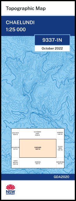
Chaelundi 1-25,000 NSW Topographic Map 9337-1-N
Price range: $16.95 through $28.95
Description:
Chaelundi 1-25,000 NSW Topographic Map 9337-1-N Now Print on Demand
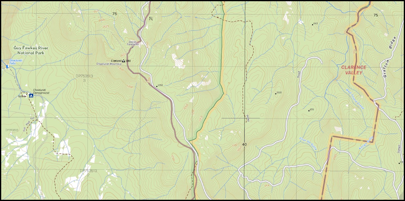
Chaelundi 1-25,000 Scale NSW Topographical Map is used for Walking, 4WD, Fishing, Camping, Motorcycle, both On and Off Road, Gold Prospecting and for those simply going for a family weekend drive.
Topographical maps show not only Contours of the Terrain but also Walking Tracks, Sealed and Unsealed Roads, Rivers, Creeks, Lakes, Historical Point of Interest, Old Mine Sites mbtg and National and State Park areas.
This map includes the following localities: Apetalum Creek Apetalum Gully Barren Creek Barren Gully Big Bull Creek The Bluff Broken Back Knob Browns Camp Creek Chaelundi Chaelundi Bluff Chaelundi Creek Chaelundi Falls Chaelundi Mountain Chandler Combalo Hut Combalo Spur Devils Forehead Fiddlers Spur First Up Gully Grafton Grafton Ridge Guy Fawkes Crag Guy Fawkes National Park High Pinnacle Housewater Creek Kanga Gully Camp Creek Chaelundi Mount Endawurri Creek First Creek The Grafton Range Kanga Creek Kittys Creek Late Lunch Creek Late Lunch Gully Lucifers Thumb Lunchtime Creek Lunchtime Gully Main Range Marengo Mest Creek Middle Creek Middle Creek Flora Reserve Middle Creek Hut Moorwurri Creek Mount Ross Never Never Nilskeeta Creek Nilskeeta Gully Parish Creek Parish Gully Petrogate Creek Pine Creek Plain Black Creek Plain Creek Punchs Creek Reccy Creek Reccy Gully Red Herring Hill Red Range The Red Range Rubina Creek Rubina Gully Soil Browns Creek Top Creek Wallaby Point Well Found Creek Wurriyan Wooriyan Creek Wurriyan Wooriyan Gully Doubtful Gully Downfall Creek Doubtfull Creek Ironbark Creek The Fattening Paddock
| Scale: | 1:25,000 |
| Latitude Range: | 30 00.0 S – 30 07.5 S |
| Longitude Range: | 152 15.0 E – 152 30.0 E |
| Approx Print Size: | 0.56m X 1.11m |
| Projection: | Transverse Mercator
GDA 2020 Edition 2022 |
You may also like…
-
Hernani 1-25,000 NSW Topographic Map 9337-2-N
Price range: $16.95 through $28.95Select options This product has multiple variants. The options may be chosen on the product page -
Marengo 1-25,000 NSW Topographic Map 9337-1-S
Price range: $16.95 through $28.95Select options This product has multiple variants. The options may be chosen on the product page -
Kookabookra 1-25,000 NSW Topographic Map 9337-4-N
Price range: $16.95 through $28.95Select options This product has multiple variants. The options may be chosen on the product page -
Lyndhurst 1-25,000 NSW Topographic Map 9337-3-N
Price range: $16.95 through $28.95Select options This product has multiple variants. The options may be chosen on the product page