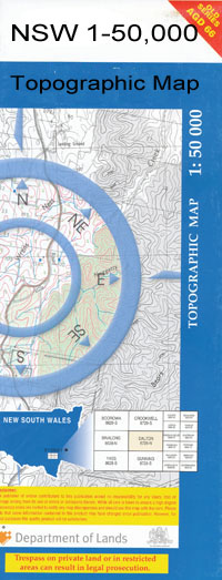
Mogriguy 1-50000 NSW Topographic Map
$16.95 – $31.95
Description:
Mogriguy 8633-N 1-50,000 scale NSW Topographical map is used for Walking, 4WD, Fishing, Camping, Motorcycle, both On and Off Road, Gold Prospecting and for those simply going for a family weekend drive.
Topographical maps show not only Contours of the Terrain but also Walking Tracks, Sealed and Unsealed Roads, Rivers, Creeks, Lakes, Historical Point of Interest, Old Mine Sites and National and State Park areas.
 We can Now LAMINATE and fold your map for $12.00. Just click on the image and add to the Trolley
NOW AVAILABLE PRINT ON DEMAND
Locations within this Map
Brocklehurst Dubbo Ballimore Back Creek Ballimore Creek Ballimore Cemetery Ballimore Hill Ballimore Platform Ballimore Public School Baragonumbel Creek Barbigal Barbigal Hill Barbigal Loop Barbigal Railway Station Barden Park Belarbigal Billabong Village of Beni Beni Beni Creek Beni National Forest Beni or Deep Creek Beni Railway Station Beni State Forest Bickan Bickanbeenie Biddybunge Park Black Jacks Gully Boothenba Boothenba Railway Station Boundary Creek Breesouth Brocklehurst Public School Bruah Caledonia Cave Hill Coolbaggie Coolbaggie Creek Daley Dubbo College Delroy Campus Devils Hole Erskine Goan Goan Creek Goondy Creek Goonoo Goonoo Gully Goonoo State Forest Hamilton Fall Haystack Pinnacle Jones Creek Coalbaggie Creek Coalbaggie Cobrauraguy Creek Coobaggie Creek Cooners Creek Globelands Goan Swamp Goonoo Dam Hamilton Falls Haystack Hill Lady Cutler Park The Little Pinnacle Maliphant Park Manera Heights Medway Creek Midway Creek Mitchell Creek Mitchells Creek Mogriguy Mogriguy Creek Mogriguy Public School Mogriguy Railway Station Mogriguy State Forest Mugga Hill Muller Park Mungamine Murngundy Muronbung Muronbung Railway Station Murrungundie Myall Street Narrabrough Creek Orana Heights Orana Heights Public School Peters Creek Peters Gully Pioneer Park Plain Creek Powter Park Rocky Creek Sandy Beach Park Sandy Creek Scrubby Creek Sir Roden Cutler Park Solitary Creek Spring Creek Stoney Gully Stony Creek Talbragar Talbragar Railway Station Teresa Maliphant Park Terramungamine Terramungamine North Terramungamine Reserve Terramungamine Tank The Pinnacle Tin Hut Dam Troy Creek Troy Crossing Troy Fall Troy Gully Troy Junction Victoria Park Western Branch of Jones Creek Whylandra Creek Willandra Creek Woodhouse Dam Woolandra Creek Yarindury Yarindury Flora Reserve Yarindury State Forest Yarracreen Creek Yellow Creek Youngs Creek Dewar Dubbo Airport Dubbo Base Hospital Public School Dubbo Cemetery Dubbo High School Dubbo Post Office Dubbo Racecourse Dubbo Railway Station Dubbo Showground Dubbo State Forest Dubbo Technical College Dubbo Astro Dubbo General Cemetery Bunglegumbie Bungle Gumbie Bunglegumbie Fall Bungle Gumbie Fall Burrabadine Mogriguy Flora Reserve Wiradjuri Park Lions Park Branch Creek Buninyong Public School Dubbo College Senior Campus Durraween Mugga Downs Old Harbour Richmond North Burrabadine Jaymark Yarandale Darralume Rawsonville Spicers Creek Muronbong Woolandara Creek Talbragar River Talbragar Creek Dubbo Municipality Long Gully Creek
| Name: | Mogriguy |
| Publisher: | New South Wales Government |
| Scale: | 1:50000 |
| Latitude Range: | 32° 00.0′ S – 32° 15.0′ S |
| Longitude Range: | 148° 30.0′ E – 149° 0.0′ E |
| Datum: | GDA 94 |

