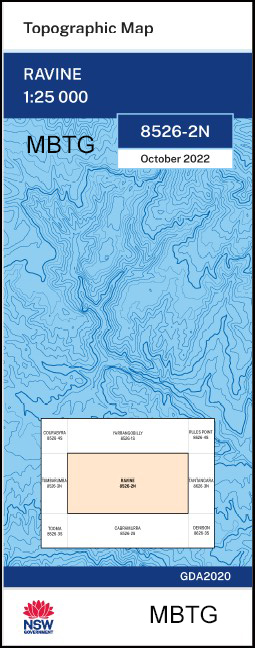
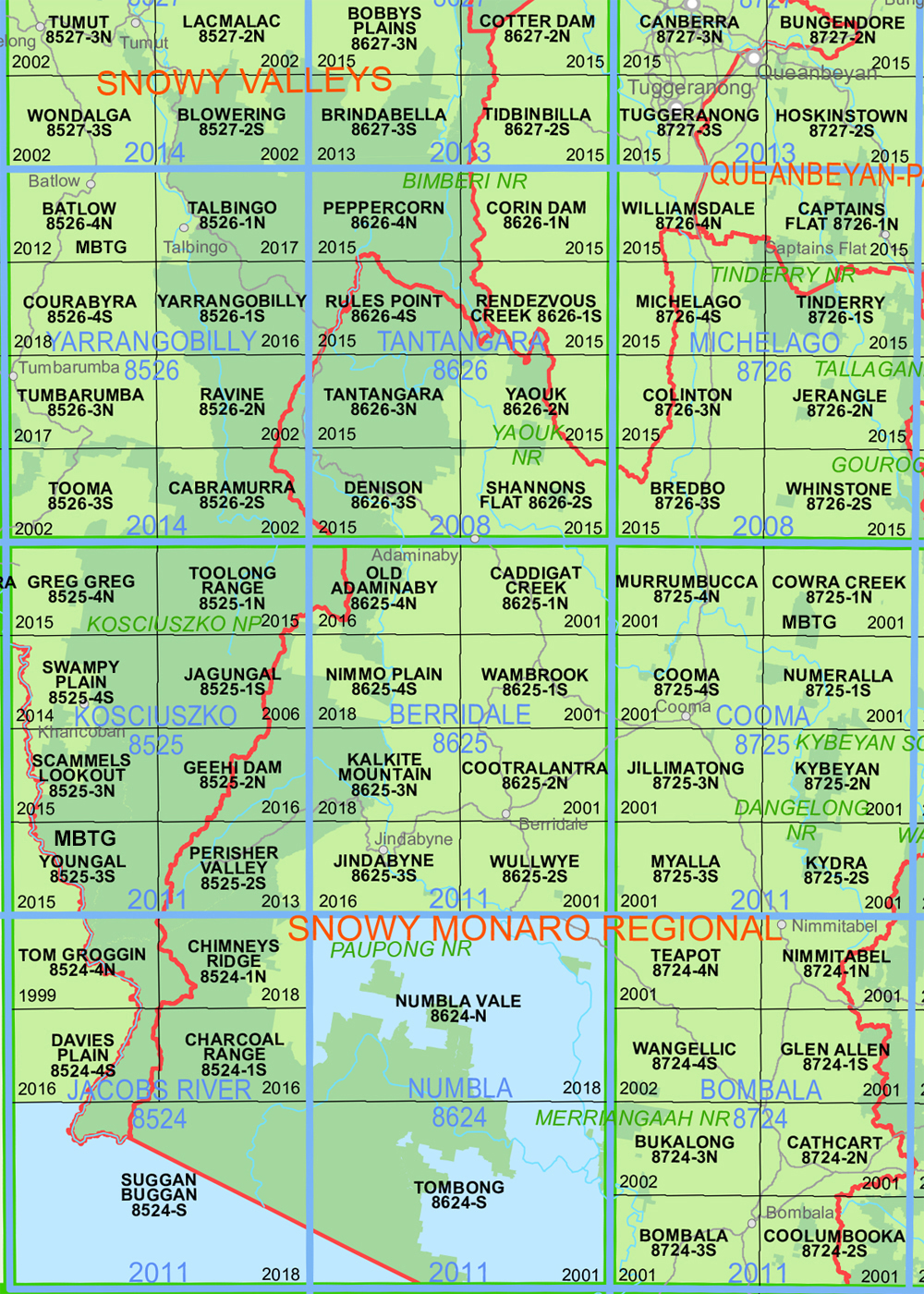
Ravine 1-25,000 NSW Topographic Map
$16.95 – $29.95
Description:
Ravine 1-25,000 NSW Topographic Map8526-2-N Print on Demand 2022 Edition
Ravine 1-25,000 scale NSW Topographical map 85262N is used for Walking, 4WD, Fishing, Camping, Motorcycle, both On and Off Road, Gold Prospecting and for those simply going for a family weekend drive.
Topographical maps show not only Contours of the Terrain but also Walking Tracks, Sealed and Unsealed Roads, Rivers, Creeks, Lakes, Historical Point of Interest, Old Mine Sites mbtg and National and State Park areas.
Now also available on Waterproof Plastic Paper Folded
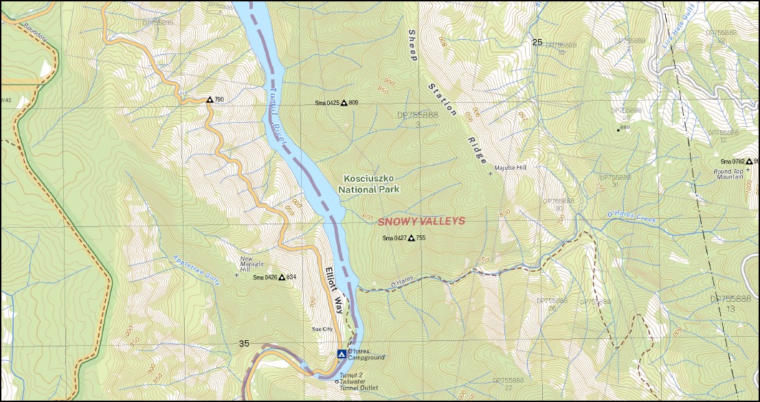
Main Features of this map includes: AAWT South Talbingo Reservoir, , Yarrangobiily River, Part of the Australian Alpine Walking Track, Round Top Mountain Marargle State Forest, Appletree Gully Back Creek Bago State Forest Beebys Gully Big Gunyam Creek Brandy Mary Spur Cave Gully Chambers Creek Coultons Creek Crack Hardy Point Dalys Creek Dead Mans Ridge Garden Gully Giandarra Gully Gibsons Plains Highground Creek Cave Creek Feathertop Round Top Giandarra Creek Kiandra Plain Lick Hole Creek Lick Hole Gully Logbridge Creek Mcphersons Plain Maddens Creek Majuba Hill Manjar Maragle Creek Maragle Hill Maragle Range Maragle State Forest Marica Milk Shanty Milk Shanty Creek Modder Creek Modder River (Sparkes Creek) Murphys Creek Murphys Gully Native Dog Creek New Chum Hill New Maragle Creek New Maragle Hill New Maragle State Forest New Zealand Gully Nurenmerenmong O’Hares Creek O’Hares Hill O’Hares Ridge O’Hares Spur Pennyweight Creek Pilot Reef Mountain The Pilot Reef Pinchgut Creek Pollocks Creek Prospector Creek Racecourse Creek Ravine General Cemetery Village of Ravine Ravine Reeds Hill Richardsons Creek Round Top Mountain Section Creek Section Ridge Selwyn Shaw Hill Sheep Station Creek Sheep Station Ridge Sparkes Creek Stable Creek Stable Walls Sue City Sue City Camp The Cliffend Walls The Five Corners The High Ground The Sounding Ground Three Mile Creek Wallace Wallaces Creek The Walls Wargunyah Creek Whipstick Creek Whipstick Gully Yans Creek Yans Gully Yellow Creek Yorkers Creek Bullock Head Creek Bullocks Head Creek Byron Byrons Range Byrons Ridge Beebys Creek Kiandra Creek
| Scale: | 1:25000 |
| Latitude Range: | 35 45.0 S – 35 52.5 S |
| Longitude Range: | 148 15.0 E – 148 30.0 E |
| Approx Print Size: | 0.56m X 1.11m |
| Projection: | Transverse Mercator
GDA 2020 Edition 2022 |
You may also like…
-
Australian Alpine Walking Track Map Set 1
$390.00 – $600.00Select options This product has multiple variants. The options may be chosen on the product page -
Denison 1-25,000 NSW Topographic Map
$16.95 – $29.95Select options This product has multiple variants. The options may be chosen on the product page -
Australian Alpine Walking Track Map Set 2
$425.00 – $625.00Select options This product has multiple variants. The options may be chosen on the product page -
Tantangara 1-25,000 NSW Topographic Map
$16.95 – $29.95Select options This product has multiple variants. The options may be chosen on the product page