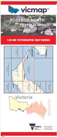
ROSEBUD NORTH 1-25,000 Vicmap Topographic Map 7821-2-N
Price range: $14.00 through $26.00
Description:
ROSEBUD NORTH 1-25,000 Vicmap Topographic Map 78212N Now Print On Demand is used for Walking, 4WD, Fishing, Camping, Motorcycle, both On and Off Road, Gold Prospecting and for those simply going for a family weekend drive.
This is a new series of 1-25,000 scale maps, all of Victoria is now covered by these maps, including maps over the South Australian and NSW Borders.
Topographical maps show not only Contours of the Terrain but Walking Tracks, Sealed and Unsealed Roads, Rivers, Creeks, Lakes, Historical Points of Interest, Old Mine Sites, mbtg and National and State Park areas.
Main Features of this map includes:
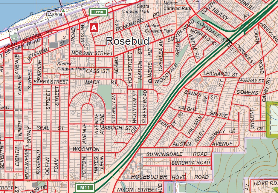
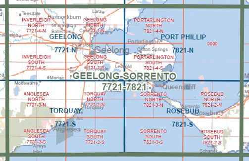
Covers the Old Series Dromana
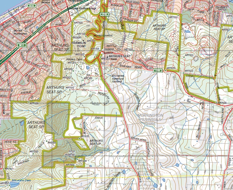
Small inset map of Mud Island. Rosebud, Balcombe Point, Martha Cliff, Mount Martha, Martha Point, Dromana Pier, Bald Hill Creek, Sorrento Pier, St Pauls, The Dog Head, Blairgowrie, White Cliffs, Pelly Point, Spray Point, Rye Pier, Capel Sound, Arthurs Seat SP, Franklin Point, Murrays Lookout, Kings Waterfall, McLarens Dam, McKellar Walk Circuit, Two Bays Walking Track, Koreen Point, Bridgewater Bay. Elwers Road
You may also like…
-
ROSEBUD SOUTH 1-25,000 Vicmap Topographic Map 7821-2-S
Price range: $14.00 through $26.00Select options This product has multiple variants. The options may be chosen on the product page -
Mornington Peninsula Paper & Laminated Meridian
Price range: $19.95 through $36.95Select options This product has multiple variants. The options may be chosen on the product page -
Rosebud 1-50,000 Vicmap
Price range: $12.00 through $24.00Select options This product has multiple variants. The options may be chosen on the product page -
The Peninsula Spec Bellarine Mornington 1-50,000
Price range: $12.00 through $24.00Select options This product has multiple variants. The options may be chosen on the product page