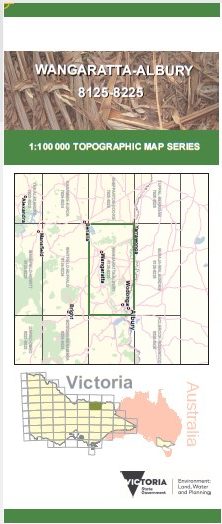
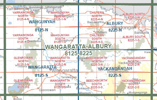
WANGARATTA ALBURY 1-100,000 Vicmap Topo 8125-8225
$14.00
Description:
WANGARATTA ALBURY 1-100,000 Vicmap Topographic Map 8125-8225 NOW PRINT ON DEMAND is used for Walking, 4WD, Fishing, Camping, Motorcycle, both On and Off Road, Gold Prospecting and for those simply going for a family weekend drive.
This is a new series of 1-100,000 scale maps, all of Victoria are covered by these maps.
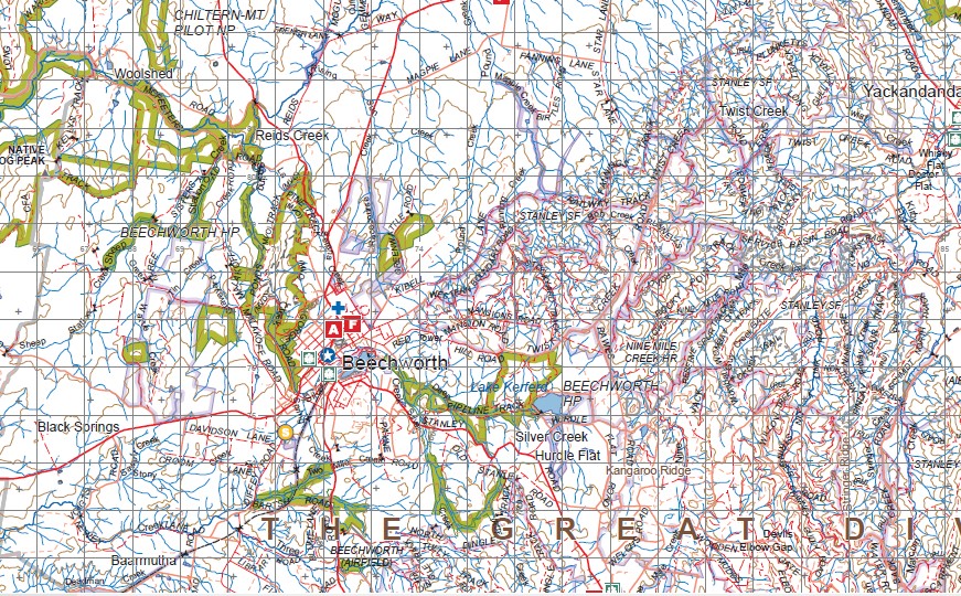
Topographical maps show not only Contours of the Terrain but Walking Tracks, Sealed and Unsealed Roads, Rivers, Creeks, Lakes, Historical Points of Interest, Old Mine Sites and National and State Park areas.
Main Features of this map includes:
Albury, Yackandandah, Wahgunyah, Yarrwonga, Wangaratta, Glenrowan, Beechworth Chilton, Bundalong, Boomahnoomoonah, Wilby, Bungeet, Thoona, MOUNT BRUNO, Chesney Vale, Wnton Wetlands, Taminick, Mount Glenrowan, Laceby, Waldara, Warby Range, MOUNT KILLAWARRA, WARBY-OVENS NATIONAL PARK, Peechelba, Dugays Bridge, Boorhaman, Corowa, Rutherglen, Bowser, Oxley, Milawa, Markwood, Brookfield, Everton, Tarrawingee, Eldorado, Londrigan, Springhurst, Chilton Pilot National Park, Liiliput, Mount Ophir, Gooramadda, MOUNT OCHTERTYRE, Barnawartha, Mount Pilot, MOUNT BARAMBOGIE, Rieds Creek, Baarmutha, Taylor Gap, Murmungee, Whorouly, Mount Flagstaff, Mount Stanley, Stanley, Wooragee, Twist Creek, Indigo Upper, Wodonga, Baranduda, Mount Baranduda, Allans Flat, MOUNT MURRAMURRANGBONG, Osbornes Flat, Dederang, Mount Jack
You may also like…
-
Wangaratta 1-50,000 Vicmap
Price range: $12.00 through $24.00Select options This product has multiple variants. The options may be chosen on the product page -
Yackandandah 1-50,000 Vicmap
Price range: $12.00 through $24.00Select options This product has multiple variants. The options may be chosen on the product page -
Albury 1-50,000 Vicmap
Price range: $12.00 through $24.00Select options This product has multiple variants. The options may be chosen on the product page -
Wahgunyah 1-50,000 Vicmap
Price range: $12.00 through $24.00Select options This product has multiple variants. The options may be chosen on the product page