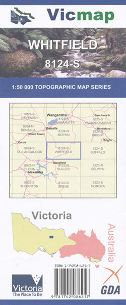
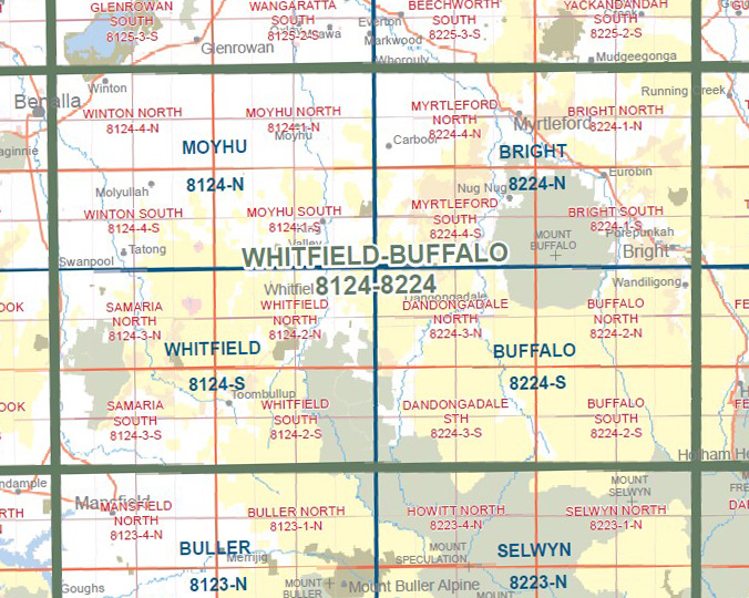
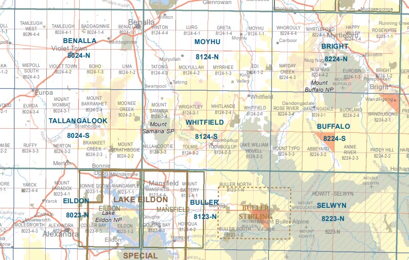
Whitfield 1-50,000 Vicmap
Price range: $12.00 through $24.00
Description:
Whitfield 1-50,000 scale Vicmap Topographical map 8124S is used for Walking, 4WD, Fishing, Camping, Motorcycle, both On and Off Road, Gold Prospecting and for those simply going for a family weekend drive.
Topographical maps show not only Contours of the Terrain but Walking Tracks, Sealed and Unsealed Roads, Rivers, Creeks, Lakes, Historical Points of Interest, Old Mine Sites mbtg and National and State Park areas.
Main Features of this map includes:
Mount Samaria, Tolmie, Nillahcootie, Swanpool, Mount Samaria State Park, Midland Holiday Park, Lima South, Wild Dog Creek Falls Camping Area, Spring Creek Sawmill Camping Area, Moorngag, Hume And Hovell Memorial, Wrightley, Dodds Bridge, mbtg, TOOMBULLUP Historic Area,mbtg, McCall Say Reservoir, Ryan Creek Reference Area (no public access), mbtg, Tolmie, southern section of Lake Nillahcootie, The Bald Hills, Blue Range Plantation and Reference Area, Camphora Hike-In Camping Area, Wileman Track, Hat Hill FFR, Whartons Crossing, Barwite, Mcraes/tromps Plantation, southern part of the TOOMBULLUP Historia Area, Hollands Creek
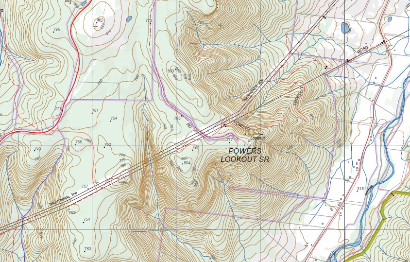
Whitfield, Whitlands, Cheshunt, Drum Top Reference Area (no public access), Peacock Spur, POWERS LOOKOUT SR, McMillans Track, Gentle Annie C & Camping Reserve, Turquoise Mine (Disused), Mount Pleasant Reference Area (no public access),Toombullup, Lake William Hovell, Archerton, Whitfield South Plantation, Round Camp Hill, Bunstons, Cambatong Reference Area, Peacock Spur, Cheshunt South, Top Crossing Camping Area, Mount View, Mount Jasper
ISBN 9781742086217
You may also like…
-
WHITFIELD NORTH 1-25,000 Vicmap Topo Map 8124-2-N
Price range: $14.00 through $26.00Select options This product has multiple variants. The options may be chosen on the product page -
Selwyn 1-50,000 Vicmap
Price range: $12.00 through $24.00Select options This product has multiple variants. The options may be chosen on the product page -
SAMARIA SOUTH 1-25,000 Vicmap Topo Map 8124-3-S
Price range: $14.00 through $26.00Select options This product has multiple variants. The options may be chosen on the product page -
WHITFIELD SOUTH 1-25,000 Vicmap Topo Map 8124-2-S
Price range: $14.00 through $26.00Select options This product has multiple variants. The options may be chosen on the product page -
SAMARIA NORTH 1-25,000 Vicmap Topo Map 8124-3-N
Price range: $14.00 through $26.00Select options This product has multiple variants. The options may be chosen on the product page -
Bright 1-50,000 Vicmap
Price range: $12.00 through $24.00Select options This product has multiple variants. The options may be chosen on the product page -
Buller 1-50,000 Vicmap
Price range: $12.00 through $24.00Select options This product has multiple variants. The options may be chosen on the product page -
Eildon 1-50,000 Vicmap
Price range: $12.00 through $24.00Select options This product has multiple variants. The options may be chosen on the product page