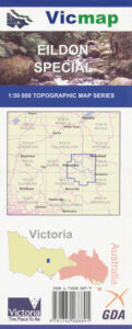
Eildon 1-50,000 Vicmap
$12.00 – $24.00
Description:
Eildon 1-50,000 scale Vicmap Topographical map 8023N is used for Walking, 4WD, Fishing, Camping, Motorcycle, both On and Off Road, Gold Prospecting and for those simply going for a family weekend drive.
Topographical maps show not only Contours of the Terrain but Walking Tracks, Sealed and Unsealed Roads, Rivers, Creeks, Lakes, Historical Point of Interest, Old Mine Sites mbtg and National and State Park areas.
Main Features of this map include:
To Cover all of Lake Eildon see the Eildon Special 1-50,000 scale topo map below
Alexander, Molesworth, Gobur, Mount Paradox, Cheviot Railway Tunnel, Rail Trails, Goulburn River, mbtg, North East part of Lake Eildon, Boonie Doon, Maindample, Woodfield Tressle Bridge, United Kingdom Gap, MAINTONGOON, Brankeet Inlet, Kennedy Point, Peppin Point, CHINAMAN HILL, Galvin Point, Redfern Point, Doak Point Woodbridge Point, Highett Point, Crockett Bay, Parkers Point, mbtg, Delatite Arm, Bryant Inlet, Point Tehan, THE PAPS NFSR and Tower, Preston Point, Ford Inlet, Burnt Creek Inlet, Maughan Point, Mcdiarmed Point and Bay, Jeep Track Flat, Parsons Point, Bostock Cove, Eildon Township and Pondage, Part of Lake Eildon at the pondage and the Goulburn River, MAINTONGOON, mbtg, Jack of Clubs Spur, Blowhard Spur, Merlo Lookout High Camp, Italian Gully Mines, Solferimo Mine, Mountaineer Creek Camping Area, mbtg, School Point Point Robinson, Cook Point, Point Mead, Lakeside Campground, Stillmans Point, Bolte Bay, Taylor Bay, Anderson Harbor, Karralika Heights, Point Mason, Rennie Inlet, MOUNT ENTERPRISE, Woolshed Inlet, HARROPS HILLS, Jeep Track Flat, Martur Falls, Point Dethridge, Point Hanslow, Barnewall Inlet, Jerusalem Creek Marina & Holiday Park, edge of Jerusalem Inlet, MOUNT PINNIGER, Point Knight, Sawyers Bay, Sandersons Point, Alans Peak Track, Picnic Point, continuation of the Delatite Arm, Howes Inlet
Yarck, Mount Paradox, DROPMORE G46 BR, Caveat, Ratin Robin Rocks, Yarck Falls, Yarck Cascades, Yarck NCR, Gobur NCR, Terip Terip, Gobur, KANUMBRA, Three Sisters, Merton Gap, ENIGMA HIL, Fawcett, United Kingdom Gap, mbtgAlexandra, Molesworth, Mount Concord, Goulburn River, Jacks Falls, Lower Jacks Falls, Little Jacks Falls, Sheepwash Lagoon, WHANREGARWEN BR, Cheviot Railway Tunnel, Tunnel Hill, Great Victoria Rail Trail, Native Dog Gap, Limestone, Mount Cunningham, Mount Nibo, mbtg, Mount Maxwell, Cathkin, Lizs Leap Falls, Wherret Track, Whanregarwen, Stillman Track, Koriella, Acheron Bridge, Halls Flat, The Breakaway, Mckenzie Flora And Fauna Reserve, Fawcett Bushland Reserve, Mount Prospect, Mount Pleasant, MAINTONGOON