


EILDON SOUTH 1-25,000 Vicmap Topographic Map 8023-1-S
$14.00 – $26.00
Description:
EILDON SOUTH 1-25,000 Vicmap Topographic Map 80231S Now Print On Demand is used for Walking, 4WD, Fishing, Camping, Motorcycle, both On and Off Road, Gold Prospecting and for those simply going for a family weekend drive.
This is a new series of 1-25,000 scale maps, all of Victoria is now covered by these maps, including maps over the South Australian and NSW Borders.
Topographical maps show not only Contours of the Terrain but Walking Tracks, Sealed and Unsealed Roads, Rivers, Creeks, Lakes, Historical Points of Interest, Old Mine Sites mbtg and National and State Park areas.
Also now available printed on Plastic Waterproof Paper Folded
Main Features of this map includes:
Covers the old series maps Collier Bay and Eildon
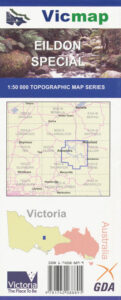
For all of Eildon on one map, you need the Eildon Special 1-50,000 topographic map below.
Eildon Township and Pondage, Part of Lake Eildon at the pondage and the Goulburn River, MAINTONGOON, mbtg, Jack of Clubs Spur, Blowhard Spur, Merlo Lookout High Camp, Italian Gully Mines, Solferimo Mine, Mountaineer Creek Camping Area, School Point Point Robinson, Cook Point, Point Mead, Lakeside Campground, mbtg, Stillmans Point, Bolte Bay, Taylor Bay, Anderson Harbor, Karralika Heights, Point Mason, Rennie Inlet, MOUNT ENTERPRISE, Woolshed Inlet, HARROPS HILLS, Jeep Track Flat, Martur Falls, Point Dethridge, Point Hanslow, Barnewall Inlet, Jerusalem Creek Marina & Holiday Park, edge of Jerusalem Inlet, MOUNT PINNIGER, Point Knight, Sawyers Bay, Sandersons Point, Alans Peak Track, Picnic Point, continuation of the Delatite Arm, Howes Inlet