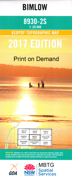
Bimlow 1-25,000 NSW Topographic Map
$16.95 – $31.95
Description:
8930-2-S
Bimlow 89302s 1-25,000 Scale NSW Topographical Map is usedfor Walking, 4WD, Fishing, Camping, Motorcycle, both On and Off Road, GoldProspecting and for those simply going for a family weekend drive.
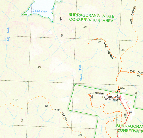
Topographicalmaps show not only Contours of the Terrain but also Walking Tracks, Sealed andUnsealed Roads, Rivers, Creeks, Lakes, Historical Point of Interest, Old MineSites and National and State Park areas.
 Laminate and folded this NSW Topographical map, $12.00 see below.
This map includes the following localities: Back Bimlow Walls Austen Steeps Alum Springs Creek Bark Ridge Bellbird Gully Bellbird Point Bend Bay Bend Creek Big Stringy Bark Range Big Wonga Mountain Blattmann Break Blattman Break Black Hollow Creek Black Coola Black Coola Creek Black Coola Mountain Bimlow Terrace Bimlow Bimlow Peak Bimlow Point Bran Jan Gully Bran Jan Hill Brereton Bend Brereton Head Mount Brereton Brereton Ridge Brimstone Bay Broken Rock Broken Rock Mountain Broken Rock Range Catt Head Cedar Road Point Commodores Hill Cooba Cooba Bay Cookem Walls Cottage Mountain Coxs River Arm Dallawang Creek Dallawang Head Dallawang Mountain Dallawang Saddle Dallawang Walls Dunns Point Emu Hill Mount Fitzpatrick Fitzpatrick Point Fritzs Creek Fritzs Hump Gogok Spur Gogongolly Bay Gogongolly Creek Gogongolly Head Gogongolly Mountain Gogongolly Ridge Green Wattle Arm Gronows Creek Grundys Hill Hall Ridge Hidden Creek Horse Arm Creek Hunt Point Junction Point Kalimbang Creek Kalimbang Spur Karil Mountain Kerswell Hill Central Burragorang Walls Dunns Corner Hall Spur Joe Quigg Head Joe Quiggs Creek Kiaramba Ridge King Hill King Point Mount Koorain Kooroogama Creek Kowmung Lookout Kowmung Range Kowong Creek Kowong Kowong Mountain Kowong Mountain Lacys Bay Little Ripple Creek Lower Burragorang Walls Lower Kowmung Canyon Lower Kowmung Gorge Mcmahons Lookouts Maxwell Point Micks Point Moodys Hill Myles O’Reilly Point New Yards Creek New Yards Ridge North Warragamba Wall Oak Ridge Oak Terrace Oaky Creek O’Reilly Point Pearces Buttress Pearces Mountain Gully Pelham Creek Mount Pippen Pippens Falls Pippens Gully Pocket Bay Pocket Creek Popes Creek Popes Mountain Quig Gully Quig Head Rigby Rock Lookout Ripple Ridge Ripple Spur Rocky Creek Rocky Range Rocky Ridge Rufford Ridge Russell Peak Sandy Creek Sandy Gully Creek Scotts Main Range Shoobridge Head Shoobridge Mountain Smiths Hill Speedwell Spotted Dog Point Stevens Point Stringybark Ridge Mount Stuart Clarke Sugarloaf Hill The Surgarloaf Sullivans Yards Creek Sullivan Yards Gully Ti-Willa Range Trial Hill Trial Hill Gully Wah Wah Creek Wah Wah Gully Wah Wah Spur Walmalu Gully Walmalu Stub Walmalu Spur Warragamba Wildlife Refuge Warragumby Point Warragumby Mountain West Bimlow Peak West Warragamba Wall Wide Opening Ridge Wide Opening Range Wonga Mountain Wonga Wonga Brook Wonga Wonga Ridge Yaluwirri Ridge Yaluwirri Spur Devitts Spur Dhulugatta Spur Devitts Range Dhulgatta Stub Bungal-Ooloo Spur Bunggalooloo Creek Bunggalooloo Ridge Burlamatta Creek Lake Burragorang Burragorang Walls Butchers Creek Arm Butchers Creek Butlers Creek Junction Bluff Junction Head Pocket Mountain Junction Mountain Kerswell Point Blattmann Point Dallawang Ridge Nelson Phillis Park
| Scale: | 1:25000 |
| Latitude Range: | 33 52.5 S – 34 00.0 S |
| Longitude Range: | 150 15.0 E – 150 30.0 E |
| Approx Print Size: | 0.56m X 1.11m |
| Projection: | Transverse Mercator |


