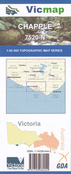
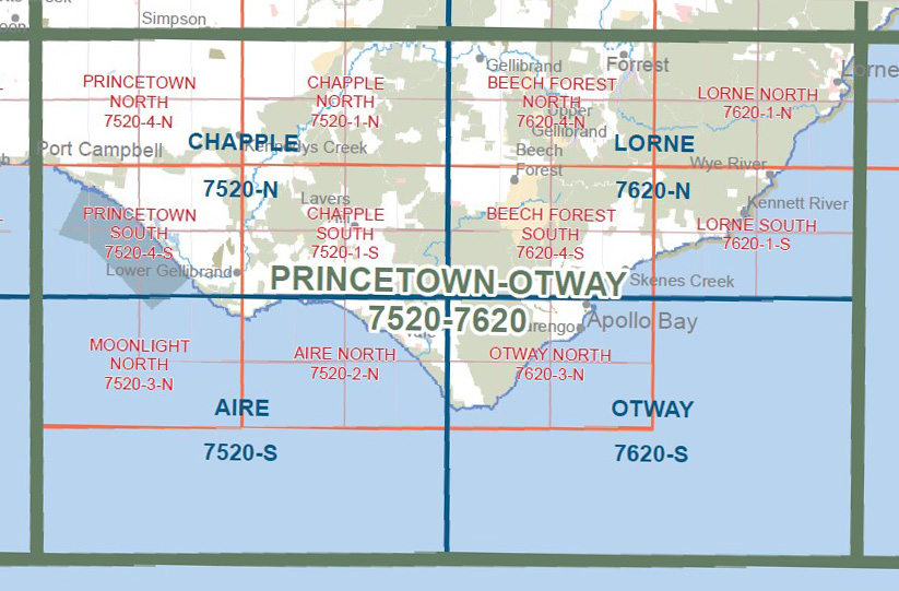
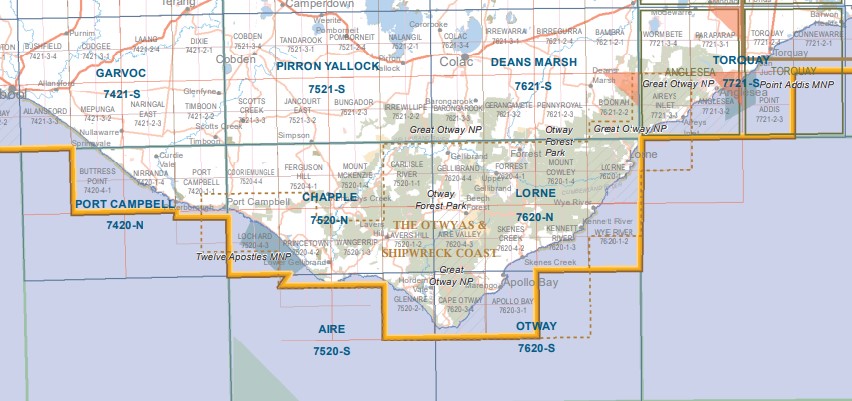
Chapple 1-50,000 Scale Vicmap Topographical 7520N
Price range: $12.00 through $24.00
Description:
Chapple 1-50,000 scale Vicmap Topographical map 7520N is used for Walking, 4WD, Fishing, Camping, Motorcycle, both On and Off Road, Gold Prospecting and for those simply going for a family weekend drive.
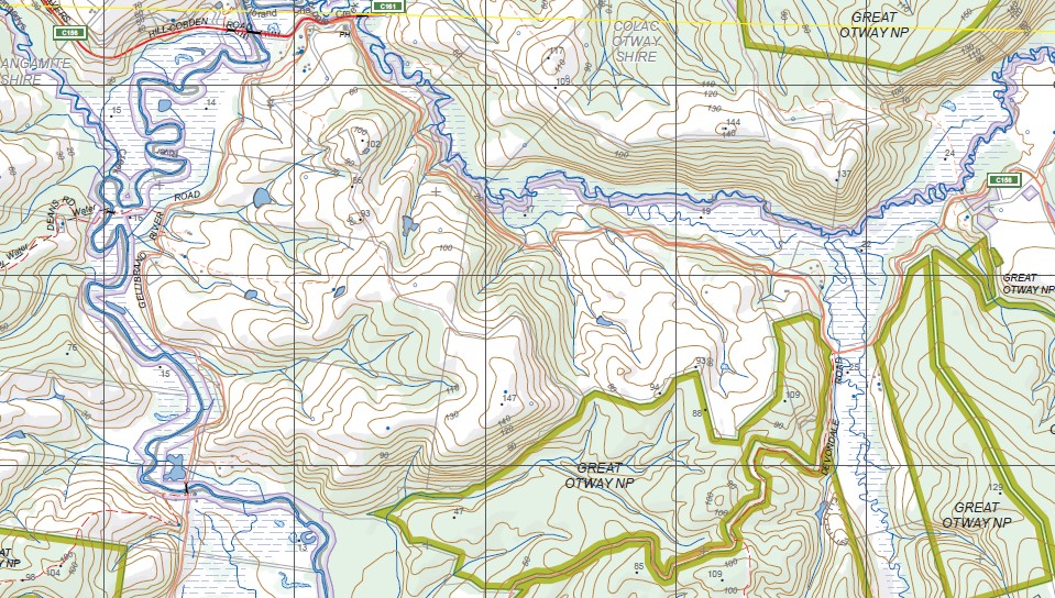
Topographical maps show not only Contours of the Terrain but Walking Tracks, Sealed and Unsealed Roads, Rivers, Creeks, Lakes, Historical Points of Interest, Old Mine Sites mbtg and National and State Park areas.
Main Features of this map includes:
Port Campbell and Port Campbell National Park, South West sections of the Great Otways National Park, Tomahawk Creek, Coradjil, Roberts Track, Flat Paddock Track, Blacks Bridge, Mount Murray, Pumping Station Track, Odowd Track, Prascevi Track, Kennedy’s Creek, Montys Track, Carlisle River, Rapier Ridge Track, Boggy Creek Track, Link Track, Sheepyard Creek, Sheepyard Track, Mount Mackenzie Track, Crinoline Creek, Camp Creek, mbtg, Crinoline Creek, Chapple Vale, Hargreaves Track, Glasgow Falls, Mowroong, Delaneys Track, Kincaid, Camp Creek, Weeaproinah, Youngs Creek, Phillips Track, Little Aire Falls Walk, Triplet Falls, Wyelangta, Mount Chapple, Moomowroong, Egan Track, Stalker, Mackenzie Track, Junction Track, The Grasstree Plain, Skinner Creek Falls, Devondale, Burrupa, Mount Acland, Nariel Creek, Madsen Falls, Lavers Hill, Upper Chapple Falls, Melba Gully, Annes Cascade, Crowes, Aire Crossing, Hall Ridge, Red Water Track, mbtg, Hefferman Track, Holy Water Track, Wait A While Creek, Bennetts Track, Wangeripp Falls, Johanna Falls, Knowledge Creek, Helens Falls, Johanna Access Falls, Yuulong, Lookout Tower, William Tower, Wattle Hill, Cape Volney Track, Milanesia Beach Falls, Ocean Walk, Calder Ridge
Cooriemungle Creek, Ross Creek, Simpson, Camp Cooriemungle, Port Campbell Creek, Cowley’s Creek, Newfield, Waarre, Sherbrooke River, Kennedy’s Creek, Kennedy Creek Track, Bryant Creek, Otway Forest Park, Sandpit Track, Ferguson Hill, Ferguson Hill No 2 Track, Port Campbell National Park, Anderson Creek, Prince Olav Creek, Otra Creek, Eastern Creek, Saltwater Creek, Freshwater Creek, Rutledge Creek, Port Campbell Bay, mbtg,
The Twelve Apostles, The Achies Marine Sactuary, Loch Ard Gorge, Survey Gorge, Ronald Point, Latrobe BR, Burrupa, Gellibrand Lower, Wattle Hill
ISBN 9781742084442
You may also like…
-
Otway 1-50,000 Vicmap
Price range: $12.00 through $24.00Select options This product has multiple variants. The options may be chosen on the product page -
Port Campbell 1-50,000 Vicmap
Price range: $12.00 through $24.00Select options This product has multiple variants. The options may be chosen on the product page -
Lorne 1-50,000 Vicmap
Price range: $12.00 through $24.00Select options This product has multiple variants. The options may be chosen on the product page -
PRINCETOWN NORTH 1-25,000 Vicmap Topo Map 7520-4-N
Price range: $14.00 through $26.00Select options This product has multiple variants. The options may be chosen on the product page -
Princetown Otways 1-100,000 Vicmap Topo 7520 7620
Price range: $12.00 through $24.00Select options This product has multiple variants. The options may be chosen on the product page -
Otways West Shipwreck Coast Map Spatial Vision
Price range: $13.95 through $28.95Select options This product has multiple variants. The options may be chosen on the product page -
Aire 1-50,000 Vicmap
Price range: $12.00 through $24.00Select options This product has multiple variants. The options may be chosen on the product page -
Otways Walking Maps Spatial Vision 3 Map Set
Price range: $39.00 through $73.00Select options This product has multiple variants. The options may be chosen on the product page -
PRINCETOWN SOUTH 1-25,000 Vicmap Topo Map 7520-4-S
Price range: $14.00 through $26.00Select options This product has multiple variants. The options may be chosen on the product page -
CHAPPLE NORTH 1-25,000 Vicmap Topo Map 7520-1-N
Price range: $14.00 through $26.00Select options This product has multiple variants. The options may be chosen on the product page