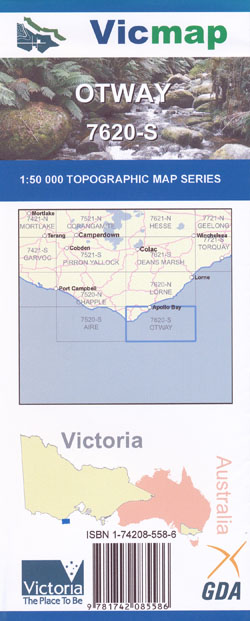
Otway 1-50,000 Vicmap
Price range: $12.00 through $24.00
Description:
Otway 1-50,000 scale Vicmap Topographical map 7620S is used for Walking, 4WD, Fishing, Camping, Motorcycle, both On and Off Road, Gold Prospecting and for those simply going for a family weekend drive.
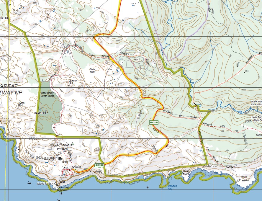
Topographical maps show not only Contours of the Terrain but Walking Tracks, Sealed and Unsealed Roads, Rivers, Creeks, Lakes, Historical Points of Interest, Old Mine Sites mbtg and National and State Park areas.
Main Features of this map includes:
From Cape Otway to Apollo Bay,
Marengo, Apollo Bay, Point Bunbury, Hayley Point, Cape Marengo, Swell Point, Storm Point, The Blowhole, Elliot River, Addis Bay Coast, Geary River Falls, Kipping Track, Beauty Gully, Blanket Bay Creek, Otway Park, Lawry Hill, Blanket Bay Falls, mbtg, Telegraph Walking Track, Johnson Track, Point Lewis, Iluka Falls, Mirage Falls, Great Ocean Walk, Horden Vale, Eddie Costin Falls, Cannan Spur, Calder River, Parker River, Snowy Ridge, Barham Paradise, mbtg, Upper Parker River Falls, Lower Parker River Falls, Katabanook Walking Track, Parker Hill Campground, Point Franklin, Seal Point, Payters Hill, Cape Otway Ocean Lodge, Bridle Track, Cape Otway, Bimbi Park, Cape Otway Lighthouse, Rainbow Falls, Flinders Point, Katabanoook Walking Track, Tower Track Hill, Bark River Falls, Crayfish Bay, Ter Hill, Toms Hill, Camp Hill, Cannan Track, Calder River
Mostly Sea and Parts of the Otway National Park
ISBN 9781742085586
You may also like…
-
Torquay 1-50,000 Vicmap Topographical Map 7721-S
Price range: $14.00 through $26.00Select options This product has multiple variants. The options may be chosen on the product page -
Aire 1-50,000 Vicmap
Price range: $12.00 through $24.00Select options This product has multiple variants. The options may be chosen on the product page -
OTWAY NORTH 1-25,000 Vicmap Topo Map 7620-3-N
Price range: $14.00 through $26.00Select options This product has multiple variants. The options may be chosen on the product page -
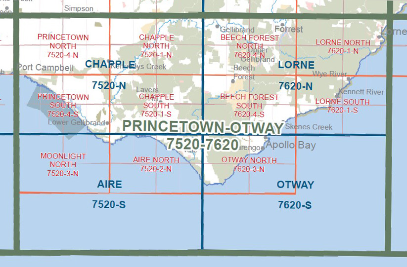
Princetown Otways 1-100,000 Vicmap Topo 7520 7620
Price range: $12.00 through $24.00Select options This product has multiple variants. The options may be chosen on the product page -
Lorne 1-50,000 Vicmap
Price range: $12.00 through $24.00Select options This product has multiple variants. The options may be chosen on the product page