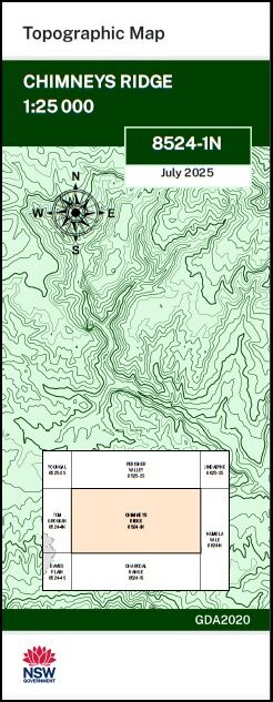

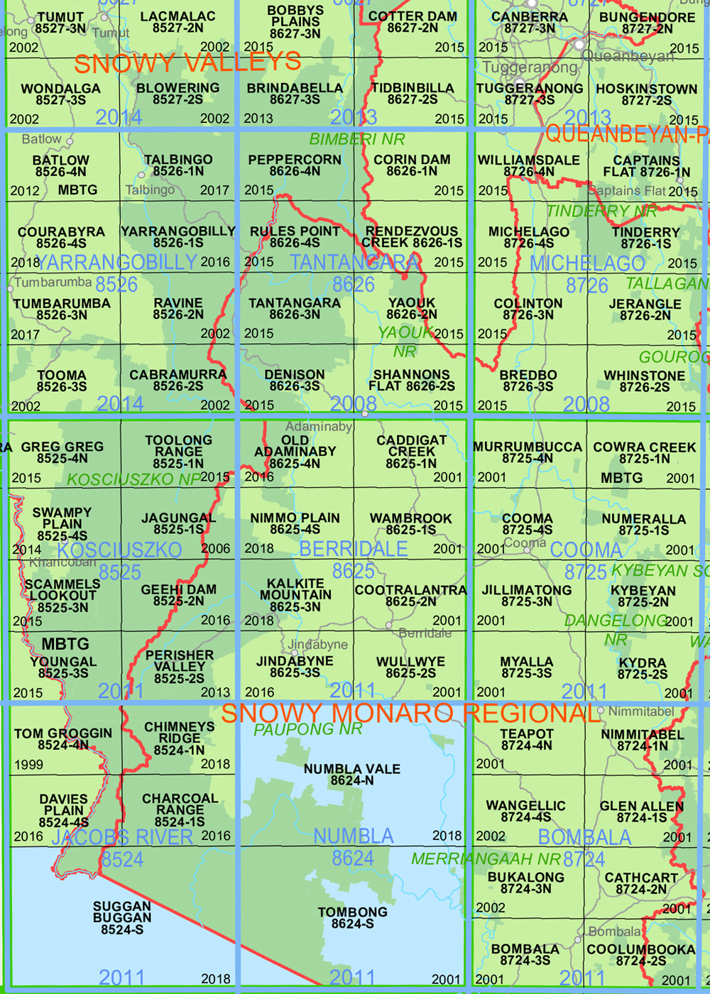
Chimneys Ridge 1-25,000 NSW Topo Map 8524-1-N
Price range: $16.95 through $29.95
Description:
Chimneys Ridge 1-25,000 NSW Topographic Map Now Print on Demand 2025 Edition
Chimney Ridge 1-25,000 Scale NSW Topographical Map is used for Walking, 4WD, Fishing, Camping, Motorcycle, both On and Off Road, Gold Prospecting and for those simply going for a family weekend drive.
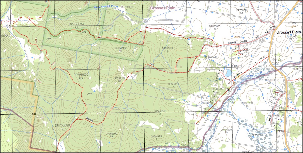
Topographical maps show not only Contours of the Terrain but also Walking Tracks, Sealed and Unsealed Roads, Rivers, Creeks, Lakes, Historical Point of Interest, Old Mine Sites mbtg and National and State Park areas.
This map includes the following localities: AAWT Thredbo Village Back Swamp Creek Back Swamp or Pig Rendezvous Creek Bobs Range Bobs Ridge Bloomfield Boggy Plain Brindle Bull Hill Brodies Camp Cascade Creek Chimneys Ridge The Chimneys Dead Horse Gap Friday Flat Creek Grosses Plain Grosses Plain Creek Horse Flat Ingebirah Jerusalem Hill Groggins Gap Ingebyra Gap Kings Arm Creek Lady Northcotes Chair Mount Leo Little Boggy Little Boggy Plain Little Rendezvous Creek Mill Creek Mill Gap Moonbah Mountain Moonbah Range Moonbah Ridge Mowamba Mowamba River Nowambah River Paradise Paradise Hill Mount Pepper Perisher Pretty Tree Creek Purgatory Hill Pergatory Hill Rendezvous Creek Rendezvous Creek or Little River Roughs Creek Round Flat Round Mountain Round Mountain Creek Sams Camp Smiths Gap Mount Stony Teatree Creek Mount Terrible Thatchers Hole Thatchers Waterhole The Big Boggy The Brindle Bull The Cascades The Round Mountain Thredbo Tommys Lake Toolong Creek Tulon Creek Tuross Creek Waterfall Creek Wild Bullock Hill Wombat Gully Drift Drift Hill Dudley Spur Dummy Salt Camp
| Scale: | 1:25,000 |
| Latitude Range: | 36 30.0 S – 36 37.5 S |
| Longitude Range: | 148 15.0 E – 148 30.0 E |
| Approx Print Size: | 0.56m X 1.11m |
| Projection: | Transverse Mercator
GDA 2020 Edition 2025 |
You may also like…
-
Charcoal Range 1-25,000 NSW Topo Map 8524-1-S
Price range: $16.95 through $29.95Select options This product has multiple variants. The options may be chosen on the product page -
Australian Alpine Walking Track Map Set 1
Price range: $390.00 through $600.00Select options This product has multiple variants. The options may be chosen on the product page -
Australian Alpine Walking Track Map Set 2
Price range: $425.00 through $625.00Select options This product has multiple variants. The options may be chosen on the product page -
Perisher Valley 1-25,000 NSW Topo Map 8525-2-S
Price range: $16.95 through $29.95Select options This product has multiple variants. The options may be chosen on the product page