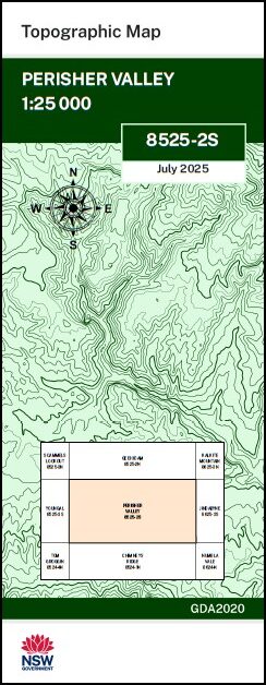
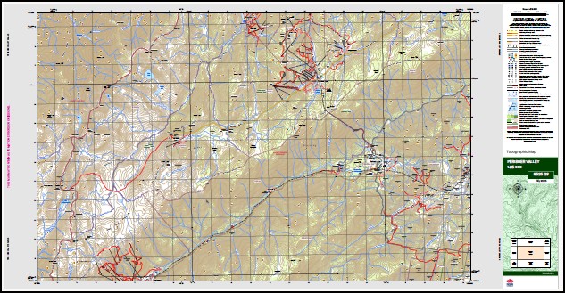
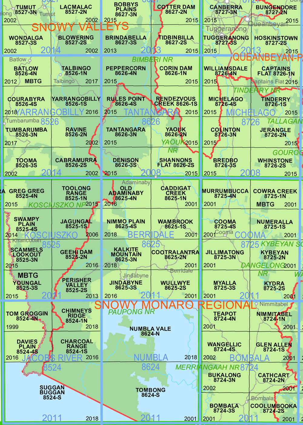
Perisher Valley 1-25,000 NSW Topo Map 8525-2-S
Price range: $16.95 through $29.95
Description:
Perisher Valley 1-25,000 NSW Topographic Map 8525-2-S Now Print on Demand Edition 2025
Perisher Valley 1-25,000 scale NSW Topographical map 85252S is used for Walking, 4WD, Fishing, Camping, Motorcycle, both On and Off Road, Gold Prospecting and for those simply going for a family weekend drive.
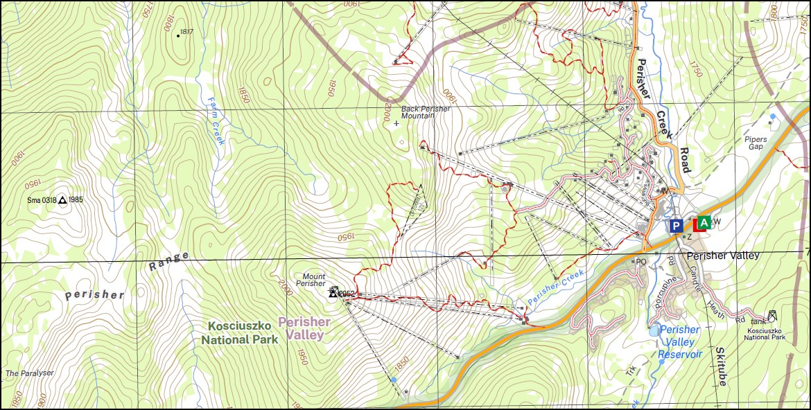
Topographical maps show not only Contours of the Terrain but also Walking Tracks, Sealed and Unsealed Roads, Rivers, Creeks, Lakes, Historical Point of Interest, Old Mine Sites mbtg and National and State Park areas.
Main Features of this map includes:
Perisher Valley Smiggin Holes Little Thredbo (Thedbo is not on this map, it’s on the Chinmey Ridge map)
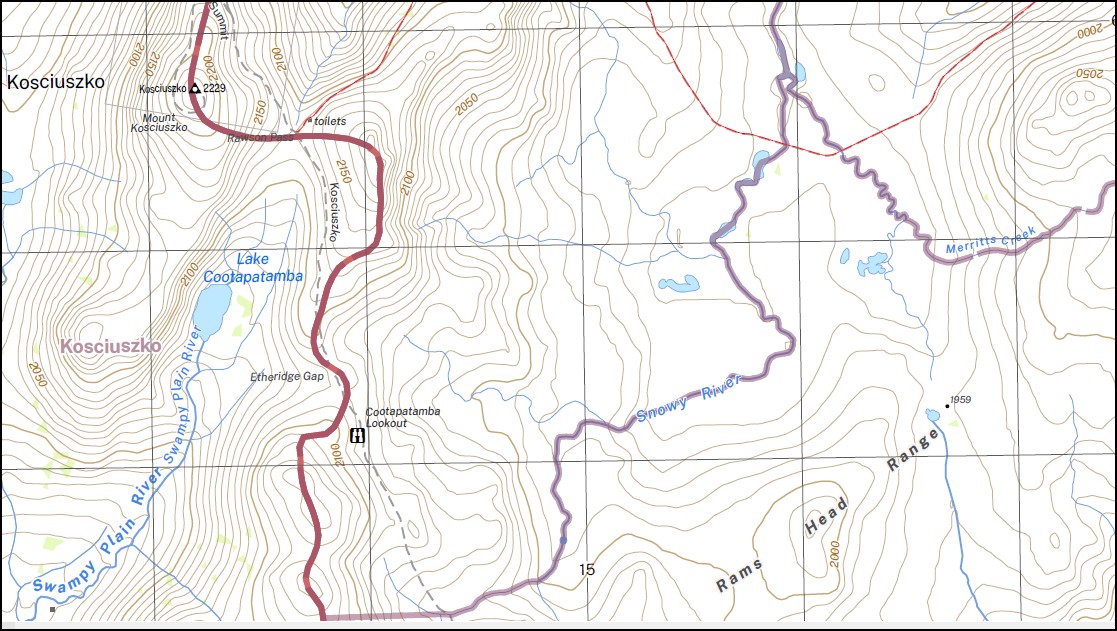
Part of the Australian Alpine Walking Track AAWT
Thredbo River
This map includes the following localities:
Perisher Village Mount Anton Mount Alice Rawson Alice Rawson Peak Albina Lake Abbot Range Abbott Ridge Abbott Peak Back Perisher Mountain The Back Perisher Betts Camp Betts Creek Blue Lake Blue Lake Creek Blue Calf Mountain The Blue Cow Mountains Blue Calf Pass Blue Cow Creek Bogong Creek Boogong Creek Camp Flat Carruthers Peak Charlottes Pass China Creek Mount Clarke Club Lake Club Lake Creek Lake Cootapatamba Crackenback Crags Creek Crummer Spur Duncan Etheridge Ridge Farm Creek Friday Flat Camp Guthega Guthega Dam Guthrie Creek Mount Guthrie Guthrie Ridge Harveys Camp Headley Tarn Johnnies Plain Kangaroo Ridge Charlotte Pass Village Crummer Range Curruthers Peak Ethel or Pounds Creek Etheridge Range Guthrie Range Guthries Creek Kangaroo Range Knob Hill Kosciusko Mount Kosciusko Lady Northcotes Canyon Lady Northcotes Creek Lake May Mount Lee Little Thredbo Little Thredbo Creek Little Thredbo River Little Twynam Lubra Creek Merritts Creek Merritts Spur Moon Rock Moraine Pass Morain Pass Muellers Peak Ngarigo Mount Northcote Northcote Pass North Ramshead No 1 Creek No 2 Creek Paddy Rushs Bogong The Paralyser Penderlea Penderlea Gap Perisher Creek Perisher Gap Mount Perisher Perisher Range Perisher Valley Mount Piper Pipers Creek Pipers Gap MBTG Porcupine Rocks The Porcupine Pounds Creek Prussian Creek Prussian Flat Prussian Plain Rainbow Lake Rams Head Rams Head North Rams Head Range Rawson Pass Rock Creek Mount Sentinel The Sentinel Smiggins Creek Smiggin Creek Smiggin Holes Snowy River Mount Stilwell Strzelecki Creek Strzelecky Creek The Chalet The Perisher Thompsons Plain Thredbo River Thredbo Valley Townsend Mount Townsend Trapyard Creek Twynam Twynam Creek Mount Twynam Upper Spencers Creek Watsons Craggs Watsons Crags Mount Wheatley Wheatleys Wollindibby Creek Wollondibby Creek Wraggs Creek Wragges Creek Wrights Creek Bull Creek Bull Flat Bullock Yard Creek Mowamba State Forest Back Perisher Thredbo Thredbo Village Pretty Point Lady Northcotes Gorge Hedley Tarn Spencers Creek Charlotte Pass Kosciuszko Mount Kosciuszko Little Austria Muellers Pass Etheridge Gap Cootapatamba Lookout Kosciuszko National Park
| Scale: | 1:25,000 |
| Latitude Range: | 36 22.5 S – 36 30.0 S |
| Longitude Range: | 148 15.0 E – 148 30.0 E |
| Approx Print Size: | 0.56m X 1.11m |
| Projection: | Transverse Mercator
GDA 2020 Edition 2025 |
You may also like…
-
Kosciuszko Alpine Area Map Spatial Vision
Price range: $19.95 through $34.95Select options This product has multiple variants. The options may be chosen on the product page -
Chimneys Ridge 1-25,000 NSW Topo Map 8524-1-N
Price range: $16.95 through $29.95Select options This product has multiple variants. The options may be chosen on the product page -
Jindabyne 1-25,000 NSW Topographic Map
Price range: $16.95 through $31.95Select options This product has multiple variants. The options may be chosen on the product page -
Australian Alpine Walking Track Map Set 1
Price range: $390.00 through $600.00Select options This product has multiple variants. The options may be chosen on the product page -
Geehi Dam 1-25,000 NSW Topographic Map 8525-2-N
Price range: $16.95 through $29.95Select options This product has multiple variants. The options may be chosen on the product page