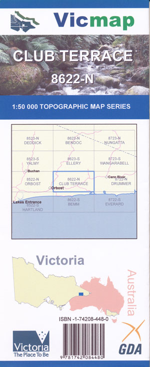
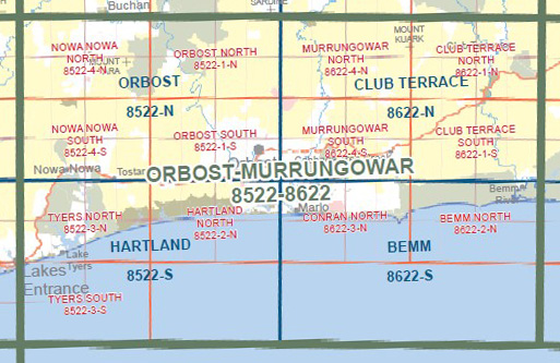
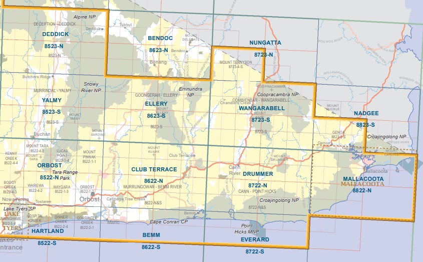
Club Terrace 1-50,000 Vicmap
Price range: $12.00 through $24.00
Description:
Club Terrace 1-50,000 scale Vicmap Topographical map 8622N is used for Walking, 4WD, Fishing, Camping, Motorcycle, both On and Off Road, Gold Prospecting and for those simply going for a family weekend drive.
Topographical maps show not only Contours of the Terrain but Walking Tracks, Sealed and Unsealed Roads, Rivers, Creeks, Lakes, Historical Point of Interest, Old Mine Sites mbtg and National and State Park areas.
Main Features of this map include:
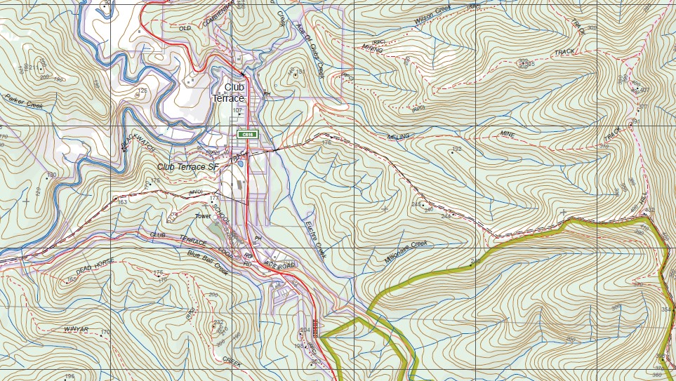
The edge of the Snowy River and Corringle Lake
Club Terrace, Club Terrace State Forest, Ellery State Forest, Murrungowar State Forest, Mount Kuark, Mount Arnold, ARTE RIVER FR, McKenzie River, ERRINUNDRA NATIONAL PARK, MOUNT PUGGAREE, Bemm State Forest, Bemm River, Lind National Park, Cann Valley State Forest, Dinah Divide, Tamboon State Forest, mbtg Manorina, Bemm State Forest, Murrungower State Forest, Bell Bird Creek and Pub, Club Terrace State Forest, Watchmaker Track, Bemm River Falls, Mount Cann, top of Sydenham Inlet
Murrungowar, Murrungowar State Forest, Mount Murrungowar, Five Tier Falls, Nurran, Yalmy State Forest, Mount Watt, Orbost State Forest, BRODRIBB FR, Mount Rich, SARDINE CREEK EA, Ellery State Forest, Mount Jack, Mount Kuark, Orbost State Forest, Young Creek Falls, Northern Lake Curlip, Tabbara, Brodribb River, Murrungowar State Forest, Mount Raymond and State Forest, Cabbage Tree Creek, CABBAGE TREE CREEK FR, Little Cabbage Tree Creek Falls, Bemm State Forest
The Northern Edge of the Cape Conran Coastal Park
You may also like…
-
Everard 1-50,000 Vicmap
Price range: $12.00 through $24.00Select options This product has multiple variants. The options may be chosen on the product page -
Mallacoota Merimbula Adventure Map Rooftop Ed 1
Price range: $12.95 through $25.00Select options This product has multiple variants. The options may be chosen on the product page -
Drummer 1-50,000 Vicmap Topographical Map 8722-N
Price range: $14.00 through $26.00Select options This product has multiple variants. The options may be chosen on the product page -
CLUB TERRACE SOUTH 1-25,000 Vicmap Map 8622-1-S
Price range: $14.00 through $26.00Select options This product has multiple variants. The options may be chosen on the product page -
Ellery 1-50,000 Vicmap
Price range: $12.00 through $24.00Select options This product has multiple variants. The options may be chosen on the product page -
Yalmy 1-50,000 Vicmap
Price range: $12.00 through $24.00Select options This product has multiple variants. The options may be chosen on the product page -
Wangarabell 1-50,000 Vicmap
Price range: $12.00 through $24.00Select options This product has multiple variants. The options may be chosen on the product page -
CLUB TERRACE NORTH 1-25,000 Vicmap Map 8622-1-N
Price range: $14.00 through $26.00Select options This product has multiple variants. The options may be chosen on the product page -
Orbost 1-50,000 Vicmap Topographical Map 8522-N
Price range: $14.00 through $26.00Select options This product has multiple variants. The options may be chosen on the product page -
Bemm 1-50,000 Vicmap
Price range: $12.00 through $24.00Select options This product has multiple variants. The options may be chosen on the product page -
Hartland 1-50,000 Vicmap
Price range: $12.00 through $24.00Select options This product has multiple variants. The options may be chosen on the product page