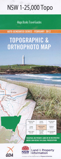
Coffs Harbour 1-25,000 NSW Topographic Map
$16.95 – $31.95
Description:
Locations within this Map
Araluen Orange Grove Orara Waters Strathclyde Woodburn Avondale Ben Nevis Rycroft Hazeldene Brooklyn Fairview Smith Vale Theders Banana Bowl Oakleigh Rockleigh Glenambee Tarrion Noorumbah Maralinga Kirralee Ayrshire Park Beechwood Park Braford Park Fairwinds Greenacres Coffs Harbour Korora Bay Sawtell Beacon Hill Big Boambee Boambee State Forest Boambee Boambee Beach Boambee Creek Boambee Creek Reserve Boambee Head Blanchards Gully Bonville Bonville Creek Brelsford Park Mount Browne Carralls Gully Charlesworth Bay Cochrans Pool Coff Coffs Harbour Airport Coffs Harbour Beach Coffs Harbour Cemetery Coffs Harbour High School Coffs Harbour Jaycee Park Coffs Harbour Jetty Coffs Harbour Jetty Post Office Coffs Harbour Plaza Post Office Coffs Harbour Post Office Coffs Harbour Public School Coffs Harbour Racecourse Coffs Harbour Showground Coffs Harbour State Forest Coffs Harbour Technical College Corambirra Point Cordwells Creek Dunvegan End Peak Englands Park Forsyth Park Fridays Creek Hargraves Park Howard Park James Smith Park Jetty Park Jordans Creek Karangi Creek Carralls Creek Harold Sealy Memorial Lookout James Smith Memorial Park Jaycee Park Korffs Harbour Korffs Islet Korora Korora Beach Korora Beach Reserve Korora Public School Kororo Nature Reserve Landrigans Loop Landrigans Railway Station Landrigans Siding Landrigans Landrigans Ballway Station Left Hand Branch Little Boambee Little Muttonbird Island Macauleys Macauleys Headland Middle Arm Middle Branch Boambee Creek Middle Creek Muttonbird Island Muttonbird Island Nature Refuge Muttonbird Island Wildlife Refuge Narranga Public School Newports Creek North Bonville North Branch Boambee Creek North Coff Island North Coff Island Wildlife Refuge North Island North Islet Orara High School Orara West State Forest Park Beach Park Beach Railway Station Red Hill Right Hand Branch Roberts Hill Robinson Hill Sawtell Golf Course Sawtell Park Sawtell Post Office Sawtell Public School Sawtell Railway Station Sealy Lookout Shepherd Park South Boambee Creek Flood Channel South Branch Boambee Creek South Branch Bonville Creek South Coffs Island South East Islet Stephen Park Toormina Toormina High School Toormina Public School Tyalla Public School Upper Orara Upper Orara Recreation Reserve Vost Park Walgarah Creek Wilson Park Wonga Park Wongiwomble Creek Diggers Head Diggers Headland Baden-Powell Park Beacon Hill Lookout Beacon Hill Park Coffs Creek Coffs Harbour Creek Coffs Harbour Railway Station Cordwells Creek Flood Channel Karangi Railway Station Treefern Creek Bayldon Primary School Houlahans Gully Boambee East North Boambee Valley Diggers Beach Bonville Headland Coffs Harbour Learning Centre Jetty Beach North Wall Beach Murrays Beach Sawtell Beach Poperaperan Creek Kororo Basin Karangi Bartletts Siding Paw Paw Siding Hollis Siding Wales Siding Gauids Siding Kerrs Siding Gentles Siding North Coffs Harbour McCauleys Head Friday Creek Park Beach Siding Mutton Bird Island North Coffs Island South Coff Island South Boambee Creek Middle Boambee Creek North Boambee Creek
Laminate and folded this NSW Topographical map $12.00 see below.
| Scale: | 1:25000 |
| Latitude Range: | 30° 15.0′ S – 30° 22.5′ S |
| Longitude Range: | 153° 0.0′ E – 153° 15.0′ E |
| Datum: | GDA 94 |
| Approx Print Size: | 0.56m X 1.11m |

