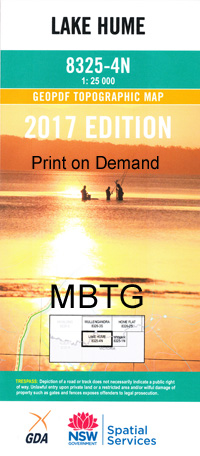
Lake Hume 1-25,000 NSW Topographic Map
Price range: $16.95 through $31.95
Description:
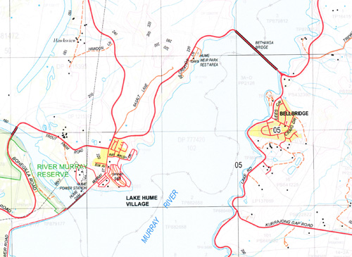
Lake Hume 8325-4-n 1-25,000 scale NSW Topographical map is usedfor Walking, 4WD, Fishing, Camping, Motorcycle, both On and Off Road, GoldProspecting and for those simply going for a family weekend drive.
Topographicalmaps show not only Contours of the Terrain but also Walking Tracks, Sealed andUnsealed Roads, Rivers, Creeks, Lakes, Historical Point of Interest, Old MineSites and National and State Park areas.
We can Now LAMINATE andfold your NSW 1-25,000 Topographical map
Locations within this Map
Talgarno Park Fairholme Essanorm Windermere Wellendban Villa Hilltop Kellpark Carinya Katoomba Rosyth Hiview Bellbridge Thurgona Thurgoona Cumboroona Hume Weir Wirlinga Hume Dam Lake Hume Village Bethanga Bethanga Creek Bethanga Fire Station Bethanga Gap Bethanga Post Office Bethanga Primary School Forest Creek Gol Creek Johnston Creek Mitta Junction Primary School Mount Talgarno Ruby Creek Talgarno Talgarno Bight Talgarno Fire Station Talgarno Primary School Talgarno Public Hall Talgarno Telephone Exchange Wise Creek Hume Reservoir Mitta Junction Bowna Creek Four Mile Creek
| Scale: | 1:25000 |
| Latitude Range: | 36° 00.0′ S – 36° 7.5′ S |
| Longitude Range: | 147° 0.0′ E – 147° 15.0′ E |
| Datum: | GDA 94 |
| Approx Print Size: | 0.56m X 1.11m |
| Publication Date: | 2014 |