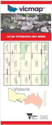
NEERIM SOUTH 1-25,000 Vicmap Topo Map 8022-2-S
Price range: $14.00 through $26.00
Description:
NEERIM SOUTH 1-25,000 Vicmap Topographic Map 80222S Now Print On Demand is used for Walking, 4WD, Fishing, Camping, Motorcycle, both On and Off Road, Gold Prospecting and for those simply going for a family weekend drive.
This is a new series of 1-25,000 scale maps, all of Victoria is now covered by these maps, including maps over the South Australian and NSW Borders.
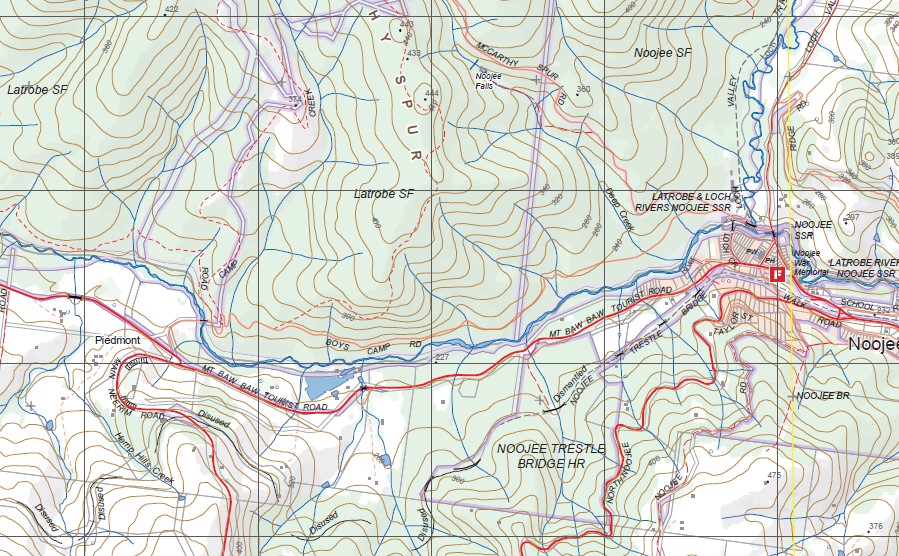
Topographical maps show not only Contours of the Terrain but Walking Tracks, Sealed and Unsealed Roads, Rivers, Creeks, Lakes, Historical Points of Interest, Old Mine Sites mbtg and National and State Park areas.
Also now available printed on Plastic Waterproof Paper Folded and Flat
Main Features of this map includes:
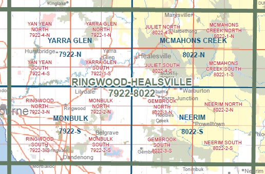
Covers the old series Neerim and Spion Kopje maps
Neerim, Spion Kopje, Learmouth Falls, Burgess Track mbtg, Seven Acre Rock, Dick Hill, part of Beenak State Forest, Bunyip Weir (Freemans Mill) Camping Area, Old Tin Mine Track, part of Bunyip State Forest, Gentle Annie, Tarago River, Bunyip Gap, The three Sisters, Slocomb And Walker Mill Site, Robinson Creek, mbtg, Labertouche State Forest, McDonald Knob, Ada River Sawmills Historic Area, Lower Goodwood Mill Site, North Hells Gate, South Hells Gate, Tarago Falls, Silvertop Spur, Whites Corner, Northern Section of Tarago Reservoir, Apex Picnic Area, Neerim Junction, Nayook, Piedmont, the edge of Noojee, Noojee Trestle Bridge Historic Area, Loch Valley Tramway Walk
You may also like…
-
NEERIM NORTH 1-25,000 Vicmap Topo Map 8022-2-N
Price range: $14.00 through $26.00Select options This product has multiple variants. The options may be chosen on the product page -
Walhalla 1-50,000 Vicmap Topo Map 8122-S
Price range: $12.00 through $24.00Select options This product has multiple variants. The options may be chosen on the product page -
Drouin 1-50,000 Vicmap
Price range: $12.00 through $24.00Select options This product has multiple variants. The options may be chosen on the product page -
NOOJEE SOUTH 1-25,000 Vicmap Topo Map 8122-3-S
Price range: $14.00 through $26.00Select options This product has multiple variants. The options may be chosen on the product page -
Neerim 1-50,000 Vicmap
Price range: $12.00 through $26.00Select options This product has multiple variants. The options may be chosen on the product page -
NOOJEE NORTH 1-25,000 Vicmap Topo Map 8122-3-N
Price range: $14.00 through $26.00Select options This product has multiple variants. The options may be chosen on the product page