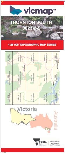
THORNTON SOUTH 1-25,000 Vicmap Topo Map 8023-2-S
Price range: $14.00 through $26.00
Description:
THORNTON SOUTH 1-25,000 Vicmap Topographic Map 80232S NOW PRINT ON DEMAND is used for Walking, 4WD, Fishing, Camping, Motorcycle, both On and Off Road, Gold Prospecting and for those simply going for a family weekend drive.
This is a new series of 1-25,000 scale maps, only certain sections of Victoria are covered by these maps.
Topographical maps show not only Contours of the Terrain but Walking Tracks, Sealed and Unsealed Roads, Rivers, Creeks, Lakes, Historical Points of Interest, Old Mine mbtg Sites and National and State Park areas.
Also now available printed on Plastic Waterproof Paper Folded
Main Features of this map includes:
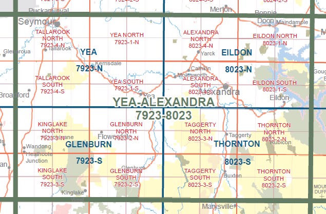
Covers the old series Royston and Margaret 1-25,000 scale maps
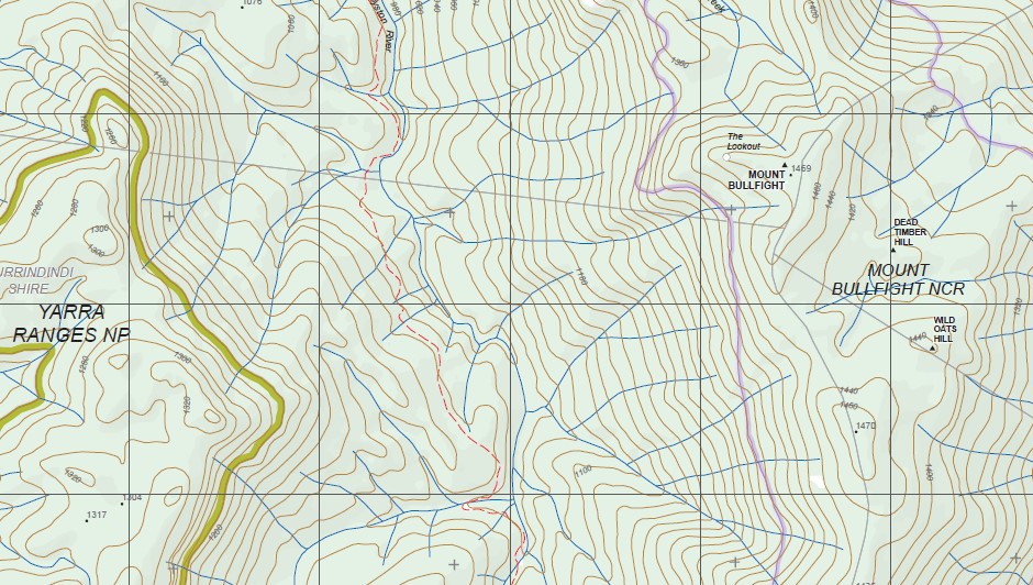
South Eastern part of the Cathedral Ranges including The Gorge, Cooks Mill Camping Area, Lower Little River Cascades, Little River Cascades, Worrun Gorge Falls, Buttress Pinnacles, Mount Sugarloaf Peak and Mount Sugarloaf Saddle, The Green Hill, Ghost Point, Gumbadik Falls, Marysville View Lookout, edge of Marysville, Keppel Ridge, Keppel Walking Track, Whitehorse Saddle, Mount Margaret, Lady Talbot Drive, Tweed Spur, CERBEREAN RANGES, Rubicon Dam, mbtg, Royston Dam, Rubicon Valley Historia Region, Long Heath, Triangle Junction, JUBILEE RIDGE, Royston Gap, Mount Bullfight, DEAD TIMBER HILL, MBTG, Stillmans Lookout, ROYSTON RANGE, Torbreck Range, Snobs Gap, WINCH HILL, COLD WEATHER RANGE, Cold Weather Hill, Dudley Saddle, Hargrave Spur, Second Creek Range, Stocco Junction, Arthurs Range, Bull Range, Gum Top Ridge
You may also like…
-
Yea 1-50,000 Vicmap
Price range: $12.00 through $24.00Select options This product has multiple variants. The options may be chosen on the product page -
THORNTON NORTH 1-25,000 Vicmap Topo Map 8023-2-N
Price range: $14.00 through $26.00Select options This product has multiple variants. The options may be chosen on the product page -
Thornton 1-50,000 Vicmap
Price range: $12.00 through $24.00Select options This product has multiple variants. The options may be chosen on the product page -
YEA ALEXANDRA 1-100,000 Vicmap Topo 7923-8023
Price range: $14.00 through $26.00Select options This product has multiple variants. The options may be chosen on the product page