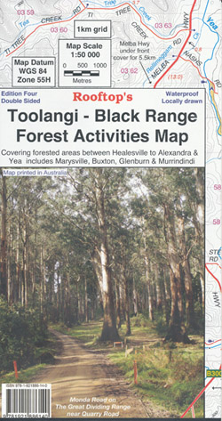
Toolangi Black Range Forest Activities Map Rooftop
$11.95
Description:
Toolangi Black Range Forest Activities Map Rooftop Waterproof
Between the Maroondah & Melba Highways
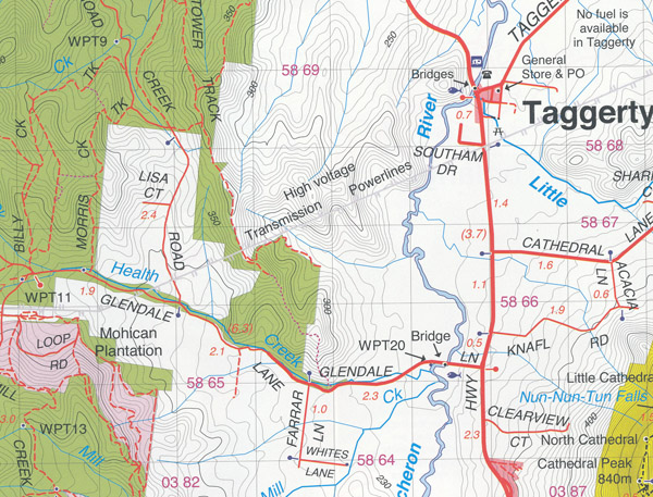
Coverage includes Toolangi, Murrindindi, Buxton, Narbethong, Wilhelmina Falls, Stanleys Homestead, Alexandra, Taggerty, Molesworth, Glenburn, Limestone, Cheviot Tunnel, Yea.
Facility symbols include Camping Areas, Caravan Parks, Picnic Areas, Fishing Spots, Lookouts, Fuel and Fire Towers.
The 1:50,000 scale map also includes, roads, vehicle, motorcycle and walking tracks; contours, elevations, and GPS co-ordinates.
New waterproof edition.
| Edition | Edition 3 |
| Publication date | 2015 |
| Map Scale | 1:50,000 |
| ISBN | 978192186140 |
Read More
You may also like…
-
Yarra Glen North 1-25,000 Vicmap Topo Map 79221N
Price range: $14.00 through $26.00Select options This product has multiple variants. The options may be chosen on the product page -
Yarra Glen 1-50,000 Vicmap
Price range: $12.00 through $24.00Select options This product has multiple variants. The options may be chosen on the product page -
Juliet North 1-25,000 Vicmap Topo Map 8022-4-N
Price range: $12.00 through $26.00Select options This product has multiple variants. The options may be chosen on the product page -
Glenburn 1-50,000 Vicmap
Price range: $12.00 through $24.00Select options This product has multiple variants. The options may be chosen on the product page -
Thornton 1-50,000 Vicmap
Price range: $12.00 through $24.00Select options This product has multiple variants. The options may be chosen on the product page -
McMahons Creek 1-50,000 Vicmap
Price range: $12.00 through $26.00Select options This product has multiple variants. The options may be chosen on the product page