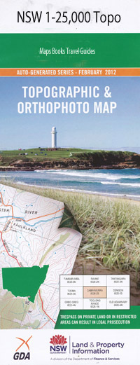
Endrick 1-25,000 NSW Topographic Map
$16.95 – $28.95
Description:
Print on demand 8927-4-S
Budawang Area Walks on this map
Sassafras – Folly Point – Hollands Gorge – Angel Creek – Monolith Valley – Long Gully
Maps Endrick, Tianjara, Corang 1-25,000
Sassafras – Newhaven Gap – The Vines – Styles Creek – Mount Haughton – Mount Tarn – Monolith Gilly – Long Gully
Maps Endrick and Corang 1-25,000
Sassafras – Newhaven Gap – Foley Point – Munnuldi Falls – Sluice Box Falls – Sturgiss Mountain – The Vines return
Sassafras – Newhaven Gap – Camp Rock – Island Mountain return
Sassafras – Newhaven Gap – Quiltys Mountain – Hiddeen Valley return
Nerriga– Round Mountain – Fosters Mountain – Square Top Mountain – Flat Top Mountain return
Locations within this Map
Alum Creek Barneys Hill Battleship Rock Blacket Creek Black Bobs Creek Binnari Pass Boonbal Creek Camping Rock Creek Camping Rock Ravine Camp Rock Cardies Point castle Hill Corang Corang Creek Corang River Crafts Crown Dark Brothers Cave Endrick Endrick State Forest English Folly Point Folly Point Lookout Forks Basin Fosters Mountain Galbraith Plateau Gallaghars Creek Gilberts Gap Grassy Creek Mount Haughton Hidden Valley Hoddle Creek Mount Hoddle Hoddles Castle Hill Hollands Creek Hollands Gorge Jerricknorra Jerricknorra Creek Careless Point Colombaco Creek Crevasse Canyon Gallaghans Creek Holland Canyon Holland Creek Kilpatrick Creek Kings Flat Little Grassy Creek Middle Creek Morton National Park Munnuldi Falls Nadgengutta Creek Narriga Nerriga Nerriga Forest Newhaven Creek Nomchong Creek Pagoda Rocks Peggys Creek Peggys Gully Piercy Creek Piercy Clearing Quiltys Clearing Quiltys Mountain Quiltys Pass Quiltys Red Ground Red Johnnys Cave Round Mountain Running Creek Sailors Gully Sallee Creek Sally Creek Sallys Creek Sassafras Sawyers Gully Sentinel Hill Sluice Box Falls Smilers Creek Square Top Mountain Strang Gully Sturgiss Mountain Styles Cave Styles Creek Tairn Mount Tanderra Camp Mount Tarn The Bald Hill Vines The Forts The Red Ground The Vines Timberlight Forest Vines Creek Whitemans Leap Mount Elliott Graeme Mitchell Lookout Watson Pass Island Mountain George Hill Dark Brother Cave Nodgengutta Creek Jericknorra Creek
| Scale: | 1:25000 |
| Latitude Range: | 35° 7.5′ S – 35° 15.0′ S |
| Longitude Range: | 150° 0.0′ E – 150° 15.0′ E |
| Datum: | GDA 94 |
| Approx Print Size: | 0.56m X 1.11m |

