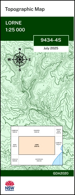

Lorne 1-25,000 NSW Topographic Map 9434-4-S
Price range: $16.95 through $28.95
Description:
Lorne 1-25,000 NSW Topographic Map 9434-4-S Print on Demand
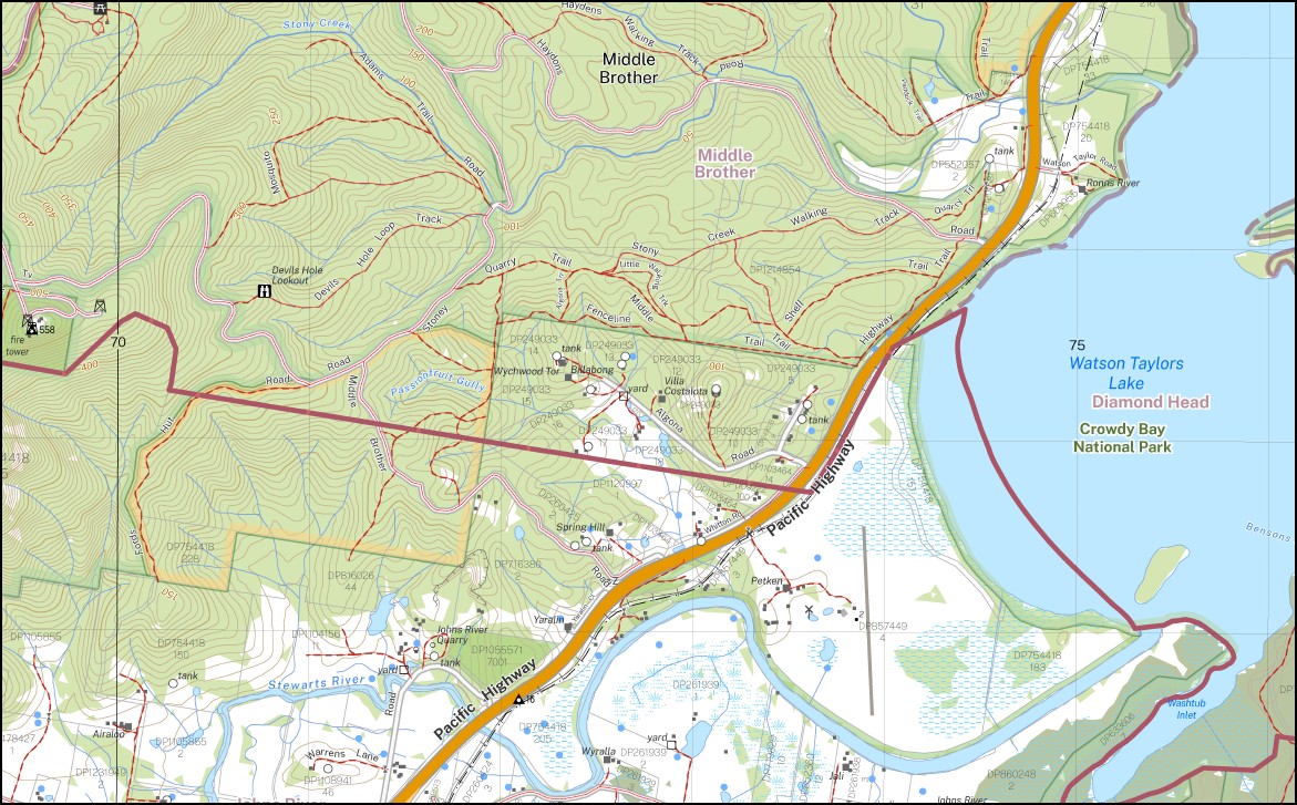
Tipperary Branchvue Peachvale Strathmar Mount Stuart Ivers Mill Blue Hills Glenrose Heatherbell Airaloo Petken Bimbedeen Lamana Redoaks Rosewood Pinecliffs Cliffdale Everston Kendall Batar Batar Creek Batars Creek Big Nellie Big Rocky Creek Black Lagoon The Black Lagoon Camden Haven Camden Haven River Charlies Hill Comboyne Comboyne State Forest Cross Creek Deep Creek Flat Rock Lookout Gills Creek Gylers Creek Hannam Vale Hannam Vale Public School Holey Flat Creek Ivers Creek Jerrys Creek John Johns River Johns River Public School Johns River State Forest Juhle Mountain Kendall District Rural School Kendall National Forest Kendall Public School Kendall State Forest Kew Camden Haven River Southern Branch John New Kendall District Public School Lansdowne Lansdowne State Forest Little Nellie Little Stony Creek Little Stony Gully Lorne Lorne Public School Mcleods Creek Manning River District National Forest Middle Brother Middle Brother National Forest Middle Brother State Forest Newbys Creek Passionfruit Creek Passionfruit Gully Rossglen Rossglen Railway Station Saddles Creek Saltwater Creek Savilles Creek Shingle Creek Shingle Gully South Brother Stewart Stewarts River Stewarts River Public School Stoney Creek Stony Creek Upsalls Creek Waitui Waitui Waterfall Washtub Inlet Washtub Bay Waterfall Creek Watson Taylors Lake West Brother Wytooee Dirty Corner Swamp Chippys Mountain Dellward Dellward Public School Devils Hole Lookout Flat Nellie Lorne Mountain Newbys Lookout Salters Creek Starrs Creek Stewarts River Southern Branch Big Nellie Flora Reserve Johns River Flora Reserve Big Gum Reserve Kerewong Camden Haven High School Camden Haven Distance Education Centre Middle Brother National Park South Brother Rock Everinghams Crossing Lansdowne Forest Cataract Creek South Branch Camden Haven River Southern Branch North Branch Camden Haven River Northern Branch Black Creek Pritchards Creek McLeods Creek Lowes Hill Wash Tub Bay Dirty Corner Bensons Creek Hannan Vale
| Name: | Lorne |
| Publisher: | New South Wales Government |
| Scale: | 1:25,000 |
| Latitude Range: | 31° 37.5′ S – 31° 45.0′ S |
| Longitude Range: | 152° 30.0′ E – 152° 45.0′ E |
| Datum: | GDA 2020
Edition 2025 |
| Approx Print Size: | 0.56m X 1.11m |
You may also like…
-
Grants Head 1-25,000 NSW Topographic Map 9434-1-N
Price range: $16.95 through $28.95Select options This product has multiple variants. The options may be chosen on the product page -
Laurieton 1-25,000 NSW Topographic Map 9434-1-S
Price range: $16.95 through $28.95Select options This product has multiple variants. The options may be chosen on the product page