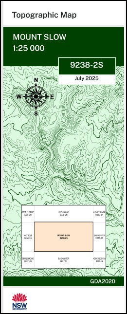


Mount Slow 1-25,000 NSW Topographic Map 9238-2-S
Price range: $16.95 through $28.95
Description:
Mount Slow 1-25,000 NSW Topographic Map 9238-2-S Print on Demand
Rosehill Carmella Glen View Eastern River Kerina Wattle Vale Fife Dale Kelvin Grove Karinya Snow Vale Flowerydale Jerrookie Woodburne The Grange Coorumbong Belle Vue Antrim Bibaringa Oak Park Woodside Glen Logan Pepperbox Rocky Point Crown View Glenielle Mount Mitchell Ben Nevis Glengare Tirranna Back Creek Bald Nob Barrons Crossing Ben Lomond Creek or Mann River Backwater Black Mountain Calvert Hill Cramptons Gully Crown Mountain Frenchies Swamp Creek Horseshoe Bend Jinkback Gully Kellys Hut Creek Mount Calvert Happy Valley Jinkbark Creek The Long Point Marowan Mosquito Mosquito Creek Mount Slow Creek Nightcap Nightcap Mountain North Branch of Little Henry River Old Paddock Creek Pensons Gully Pepperbox Hill Persons Gully Rainy Swamp Richardsons Gully Round Hill Sawpit Gully Sharkey Point Singe Whiskers Creek Single Whiskers Creek Six Mile Creek Mount Slow Tonyas Gully Warra State Forest Worra Yarrow The Burnt Hut Crown Mountain Flora Reserve Roberts Hill Pinkett Blair Hill New England Range Main New England Range New England Plateau
| Name: | Mount Slow |
| Publisher: | New South Wales Government |
| Scale: | 1:25,000 |
| Latitude Range: | 29° 52.5′ S – 30° 0.0′ S |
| Longitude Range: | 151° 45.0′ E – 152° 0.0′ E |
| Datum: | GDA 2020
Edition 2025 |
| Approx Print Size: | 0.56m X 1.11m |
You may also like…
-
Red Range 1-25,000 NSW Topographic Map 9238-2-N
Price range: $16.95 through $28.95Select options This product has multiple variants. The options may be chosen on the product page -
Dundee 1-25,000 NSW Topographic Map 9238-1-N
Price range: $16.95 through $28.95Select options This product has multiple variants. The options may be chosen on the product page -
Shannon Vale 1-25,000 NSW Topographic Map 9238-1-S
Price range: $16.95 through $28.95Select options This product has multiple variants. The options may be chosen on the product page -
Maybole 1-25,000 NSW Topographic Map 9238-3-S
Price range: $16.95 through $28.95Select options This product has multiple variants. The options may be chosen on the product page -
Rangers Valley 1-25,000 NSW Topo Map 9238-4-N
Price range: $16.95 through $28.95Select options This product has multiple variants. The options may be chosen on the product page -
Glen Innes 1-25,000 NSW Topographic Map 9238-4-S
Price range: $16.95 through $28.95Select options This product has multiple variants. The options may be chosen on the product page -
Stonehenge 1-25,000 NSW Topographic Map 9238-3-N
Price range: $16.95 through $28.95Select options This product has multiple variants. The options may be chosen on the product page