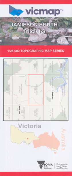
JAMIESON SOUTH 1-25,000 Vicmap Topo Map 8123-3-S
Price range: $14.00 through $26.00
Description:
Jamieson South 1-25,000 scale Vicmap Topographical map 81233S NOW PRINT ON DEMAND is used for Walking, 4WD, Fishing, Camping, Motorcycle, both On and Off Road, Gold Prospecting and for those simply going for a family weekend drive.
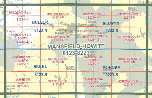
This is a new series of 1-25,000 scale maps, only certain sections of Victoria are covered by these maps.
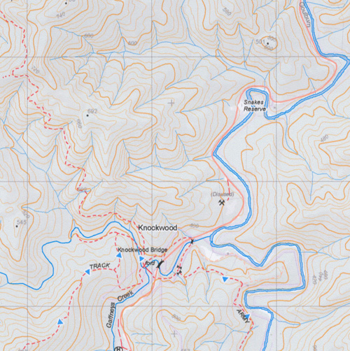
Topographical maps show not only Contours of the Terrain but Walking Tracks, Sealed and Unsealed Roads, Rivers, Creeks, Lakes, Historical Points of Interest, Old Mine Sites mbtg and National and State Park areas.
This map covers the old series Enoch Point and Gaffney’s Creek 1-25,000 topographic maps.
Also now available printed on Plastic Waterproof Paper Folded
Main Features on this 1-25,000 topographic map:-
Still Creek Range, Second Creek Range, Taponga River, Mount Duffy, Gum Top Ridge, Four Bag Reserve, Tunnel Bend Reserve, Blue Hole Reserve, Knockwood, Gaffney’s Creek, Flourbag Hill, Raspberry Point, German Spur, mbtg, Mount Terrible, Lady Elizabeth Mine, Hungarian Mine, Enochs Point, Paradise Point , MBTG, Drummond Point, View Point
You may also like…
-
JAMIESON NORTH 1-25,000 Vicmap Topo Map 8123-3-N
Price range: $14.00 through $26.00Select options This product has multiple variants. The options may be chosen on the product page -
Mansfield Mt Howitt Map Rooftop
Price range: $8.95 through $17.00Select options This product has multiple variants. The options may be chosen on the product page -
Skene 1-50,000 Vicmap
Price range: $12.00 through $24.00Select options This product has multiple variants. The options may be chosen on the product page -
Jamieson Licola Adventure Map Rooftop
Price range: $11.95 through $25.00Select options This product has multiple variants. The options may be chosen on the product page -
Buller Howitt Alpine Area Map Spatial Vision
Price range: $19.95 through $29.95Select options This product has multiple variants. The options may be chosen on the product page