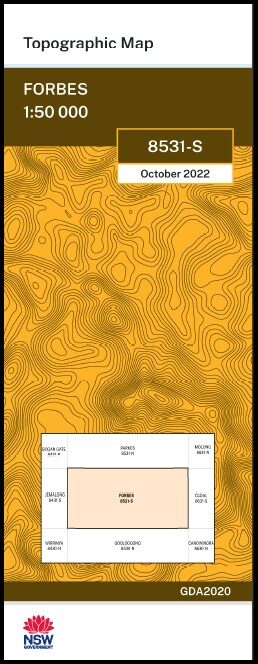

Forbes 1-50,000 NSW Topographic Map 8531-S
Price range: $16.95 through $28.95
Description:
Forbes 8531-S 1-50,000 scale NSW Topographical map is used for Walking, 4WD, Fishing, Camping, Motorcycle, both On and Off Road, Gold Prospecting and for those simply going for a family weekend drive.
Topographical maps show not only Contours of the Terrain but also Walking Tracks, Sealed and Unsealed Roads, Rivers, Creeks, Lakes, Historical Point of Interest, Old Mine Sites mbtg and National and State Park areas.
NOW AVAILABLE PRINT ON DEMAND
Locations within this Map
Heatherleigh Pine Park Rosewood Heathcote Moura Pineview Ancrum Willow Farm Glenlossie Glen Elgin Mt Lord Kokoda Clothilda Warrawee Hillside Bimbadeen Pine Vale Hillcrest Eurow Valley Alcheringa Tarlemala Kooringle Avondale Granada Grovedale Ardmona Little Dale Galwary Eulimore Springs Avalon West High Park Willanora Mooroopna Glen Ira Eugowra Warrendeine Lormax Avalon Windermere Kirribilli Kia-Ora Inglewood Island View Lorraine Ulmarra Fairview Wyona Bellview Kiembah Urana Smithfield Greylands Glenroy Lacou Springfields Cherry Tree Hill Glenisla Our Ways Nangar Walangle Yarramalong Yarranvale Karingah Allendale Buyuma Yamma Kalamazoo Roseville Akuna Mararant Wimmera Hillview Heatherview Jinarra Werai Erinundra Grove Hill Kindamindi Walla Walla Riverie Vychan Somerset Arcadia Gundamain Glengarry Rodwell Wattle View Braemar Fernlea Waugan Park Ranelagh Wirrabilla Iona Boganol Grawlin Bonnie Doon Nu Walla Tomanbil Tralee Yandilla Bandon Rosebank Fairfield Arador Devlin Nanima Clarendon Innisfail Forbes Back Yamma Back Yamma National Forest Back Yamma Public School Back Yamma State Forest Bald Hill Beddies Well Big Eulimore Hill Bonnie Dell Public School Bridge Creek Calarie Cargo Cemetery Coonambro Crippen Park Cumbijowa Cumbijowa State Forest Daroobalgie Devils Elbow Erasa Escort Rock Eugowra Nature Reserve Eugowra Cemetery Eugowra Central School Eugowra Post Office Eugowra Showground Eulimore Eulimore Creek Eurow Eurow Mountains Eurow Nyrang Mountain Forbes High School Lake Forbes Forbes Post Office Forbes Public School Forbes Railway Station Forbes Rifle Range Forbes Technical College Four Ways Galwary Creek Goimbla Green Park Grinsted Oval Half Crown Gap Half Moon Lagoon Heaney Hell Hole Creek Horseshoe Lagoon House of Commons Mountain House of Lords Mountain Jacks Leap Joss Lagoon Kennedys Creek Village of Calarie Cralwary Creek Daroobalgie Public School Eugowra General Cemetery Eugowra Public School Eugowra Racecourse and Showground Town of Eugowra Eulamore Creek Eulemaw Creek Eumimore Creek Eurow Nyrang Mountains Eurow or Sandy Creek Forbes South Public School Town of Forbes The Horse Shoe House of Lords Kinchella Creek King George V Memoral Park Lamberts Springs Lamberts Springs Creek Leaders Lagoon Licking Hole Creek Little Eulimore Hill Long Gully Long Lagoon Lords Lower Daroobalgie Mackays Creek Mackays Hill Mackeys Mount Mackays Mount Marara Creek Marara Gully Mount Eurow Muddy Lagoon Mulyandry Public School Mumbidgle Murga Mountain Native Dog Creek Nellies Lagoon Nelson Park Newells Dam One Dairy Creek Paytens Bridge Paytens Bridge Public School Mount Pleasant Pyes Gap Puzzle Flat Creek Pymont Red Bend Red Creek Round Hill Sandy Creek Scratchole Creek Snake Gully South Circle Park Spooner Oval Mount Taylor Tomambil State Forest Toms Lagoon Trajaree Trajere Troubalgie Victoria Park Wandary Wandary Lagoon Wandry or Muddy Lagoon Wanera Waugan Waugan Ford Waugan Plain White Bend Wise Wongagong Wongagong or Wongajong Creeks Wongajong Wongajong Station Bundaburrah Creek Dowling Burrabajeebar or The Muddy Lagoon Burrabajee Lagoon Union Hill Union Hill Reservoir Sir Francis Forbes Park Balmoral Daroobalgie Railway Station Eugowra Railway Station Grawlin Plains Railway Station Lions Park Red Bend Station Trajere Railway Station Mary Muir Park The Horse Shoe Lagoon Colin McKenzie Park The Bald Hill Reedy Creek Glenisia Mackays Mountain Moura Creek Grawlin Plains Mulyandry Creek Tonambil Clear Hills Mandagery Creek Rocky Peak
| Name: | Forbes 8531-S |
| Publisher: | New South Wales Government |
| Scale: | 1:50000 |
| Latitude Range: | 33° 15.0′ S – 33° 30.0′ S |
| Longitude Range: | 148° 0.0′ E – 148° 30.0′ E |
| Datum: | GDA 2020
Edition 2022 |
You may also like…
-
Molong 1-50,000 NSW Topographic Map 8631-N
Price range: $16.95 through $28.95Select options This product has multiple variants. The options may be chosen on the product page -
Parkes 1-50000 NSW Topographic Map
Price range: $16.95 through $31.95Select options This product has multiple variants. The options may be chosen on the product page -
Cudal 1-50,000 NSW Topographic Map 8631-S
Price range: $16.95 through $28.95Select options This product has multiple variants. The options may be chosen on the product page